
Archeology
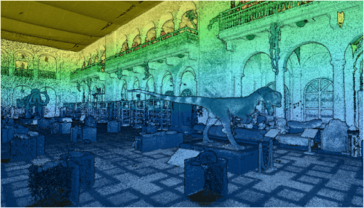
Point Density: 50,000+ points per m^2
Height: ~1.5 m AGL
Speed: Walking pace (~3-4 mph)
Data Acquisition Time: 10 minutes
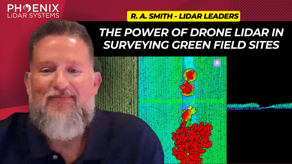
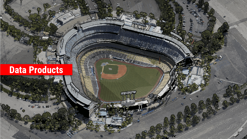
In the rapidly evolving world of surveying and civil engineering, technology plays a pivotal role in determining the efficiency and accuracy of data collection. Among the various technological advancements, LIDAR (Light Detection and Ranging) has emerged as a game-changer, especially in the area of aerial surveying. This video explores deep into the transformative impact of the Phoenix Mini Ranger 3, a state-of-the-art LIDAR system, on the workflows of R.A. Smith, a leading civil engineering and surveying company based in Brookfield, Wisconsin.
Airborne laser scanning has proven useful for rapid and extensive documentation of historic cultural landscapes after years of applications mapping natural landscapes and the built environment. The recent integration of unoccupied aerial vehicles (UAVs) with LiDAR systems is potentially transformative and offers complementary data for mapping targeted areas with high
precision and systematic study of coupled natural and human systems.
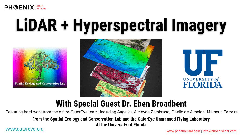
The high dimensionality of data generated by Unmanned Aerial Vehicle(UAV)-Lidar makes it difficult to use classical statistical techniques to design accurate predictive models from these data for conducting forest inventories. Machine learning techniques have the potential to solve this problem of modeling forest attributes from remotely sensed data. This work tests four different machine learning approaches – namely Support Vector Regression, Random Forest, Artificial Neural Networks, and Ex-
treme Gradient Boosting – on high-density GatorEye UAV-Lidar point clouds for indirect estimation of individual tree dendrometric metrics (field-derived) such as diameter at breast height, total height, and timber volume.

Mohawk College recently collaborated with the Niagara Parks Commission on a very important project. Mohawk was tasked with deploying their Phoenix LiDAR Scout 32 system in order to accomplish two primary objectives:
-Generate a precision high-res 3D model of the former Toronto Power Generation Station. The resulting data is to be utilized for rehabilitation work to help preserve this beautifully ornate and historically significant structure.
-Accurately scan and Geo-locate a century-old barge that had been stuck above Niagara Falls since 1918. This massive vessel dislodged itself just a few short months ago during a powerful storm. It found its new home 150 meters downstream when it lodged again, now much closer to Horseshoe Falls. Niagara Parks Officials are now monitoring for further movements, as it could shift again in the next couple of days, weeks or even years.
UAV LiDAR technology provided the Mohawk/Niagara team with the ability to Geo-locate the barge to within centimeter-level accuracy. During this mission, they were also able to scan the former Power Generation Station in order to generate a stunning, cultural-heritage preservation model.
Check out their fine work and some incredible footage from the Niagara Falls project here!
We’re excited to announce the release of LiDARMill v2! LiDARMill v2 takes automated post-processing to the next level. In our recent webinar, we covered some of the new improvements and features including:
- Imagery Processing in LiDARMill
- Ground Control Reporting and Adjustments
- Robust Coordinate System Handling
- A Workflow Overview and Demonstration
- Multi-Mission Processing Support
- Advanced Point Cloud Filtering Options
- RGB Thermal & Fusion
- Accuracy Reporting
- Automated LiDAR and Camera Calibration Options
- Near-Real Time (NRT) Reference Station Positioning for Projects Requiring Less Than 24 Hour Turn-around Time
- Trajectory Post-Processing Without Reference Stations
If you have any questions or would like to learn more about LiDARMill v2, please don’t hesitate to get in touch. We’d be happy to help!
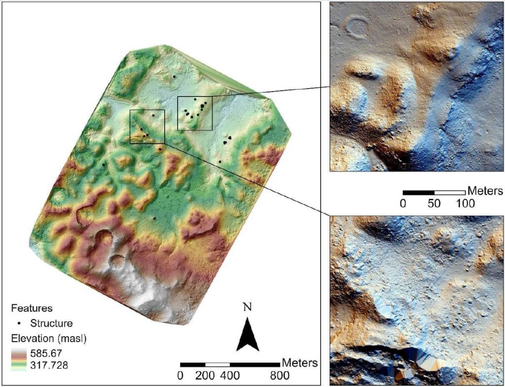
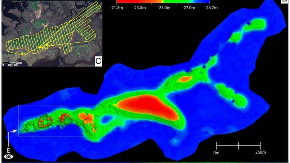
We conducted unmanned aerial vehicle lidar missions in the Maya Lowlands between June 2017 and June 2018 to develop appropriate methods, procedures, and standards for drone lidar surveys of ancient Maya settlements and landscapes. Three site locations were tested within upper Usumacinta River region using Phoenix Lidar Systems: Piedras Negras, Guatemala, was tested in 2017, and Budsilha and El Infiernito, both in Mexico, were tested in 2018. These sites represent a range of natural and cultural contexts, which make them ideal to evaluate the usefulness of the technology in the field. Results from standard digital elevation and surface models demonstrate the utility of deploying drone lidar in the Maya Lowlands and throughout Latin America. Drone survey can be used to target and efficiently document ancient landscapes and settlement. Such an approach is adaptive to fieldwork and is cost effective but still requires planning and thoughtful evaluation of samples. Future studies will test and evaluate the methods and techniques for filtering and processing these data.
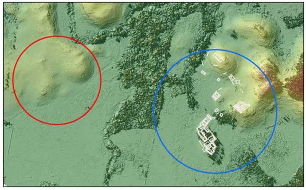
Drone-mounted, high-resolution light detection and ranging reveals the architectural details of an ancient settlement on the Gulf Coast of Florida without parallel in the Southeastern United States. The Raleigh Island shell-ring complex (8LV293) of ca. 900 to 1200 CE consists of at least 37 residential spaces enclosed by ridges of oyster shell up to 4 m tall. Test excavations in 10 of these residential spaces yielded abundant evidence for the production of beads from the shells of marine gastropods. Beads and other objects made from gulf coastal shell were integral to the political economies of second-millennium CE chiefdoms across eastern North America. At places as distant from the coast as the lower Midwest, marine gastropods were imported in raw form and converted into beads and other objects by craftspeople at the behest of chiefs. Bead making at Raleigh Island is exceptional not only for its level of production at the supply end of regional demand but also for being outside the purview of chiefly control. Here we introduce the newly discovered above-ground architecture of Raleigh Island and outline its analytical value for investigating the organization of shell bead production in the context of ancient political economies. The details of shell-ring architecture achieved with drone-mounted LiDAR make it possible to compare the bead making of persons distributed across residential spaces with unprecedented resolution.