
Environmental Engineering
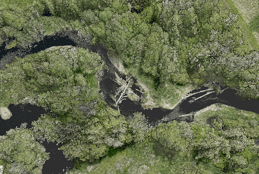
Point Density: 320 points per m^2
Height: 80 m AGL
Speed: 8 m/s
Data Acquisition Time: 7 minutes

LiDAR technology, a groundbreaking innovation in the realm of surveying and remote sensing, has been a game-changer for many industries. With its ability to provide accurate and detailed data, it’s no wonder that professionals and organizations are rapidly adopting this technology. Among the most notable advancements in this field is the use of drones for LiDAR. This video delves deep into the environmental and technical challenges faced in drone-based LiDAR, drawing insights from industry experts James Kessner and Aaron Handl of Encompass Services.
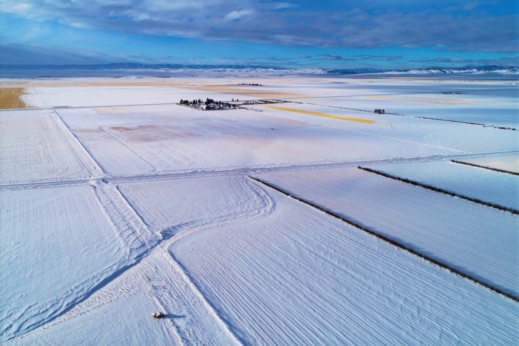
Join us for an intriguing webinar alongside Jeff Rizza of DJ&A to explore a unique UAV LiDAR project they completed for NASA and MSU earlier this year! As a contributor to the NASA SnowEx program, DJ&A used a Phoenix LiDAR system to capture highly detailed point clouds of snow surfaces that will be used by scientists for snow dynamics research. You won’t want to miss this one! Stick around until the end for a sneak peak on DJ&A’s upcoming white paper comparing UAV LiDAR and photogrammetry for topographic mapping!
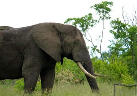
In this month’s webinar, we hosted Evan Hockridge, a Ph.D. student at Harvard University’s Davies Lab. We discussed how his team is leveraging LiDAR data and thermal imaging to map the African savanna in order to better understand how wildlife and wildfires reshape the natural landscape. Evan explained how wildlife of all sizes, from large elephants to tiny termites, reshapes the landscape and has a profound impact on the overarching ecosystem.
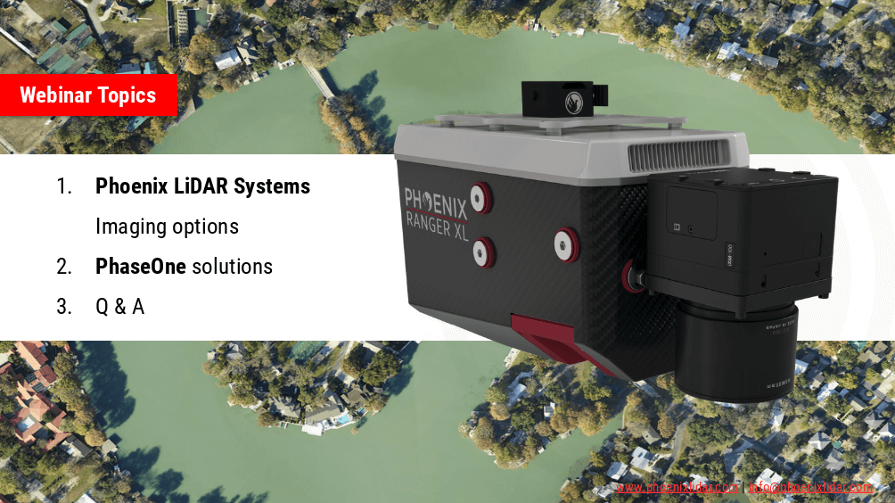
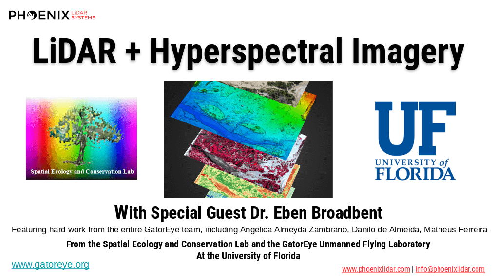
Phoenix LiDAR Systems are capable of much more than point-clouds! In this webinar we team up with our premier imaging partner, PhaseONE to showcase how two of the world’s leading aerial surveying companies are synergizing the industry to push the limits of what’s possible. Also we’ll go over our other advanced imaging systems including dual-oblique, hyperspectral, thermal, NIR, and more!
The high dimensionality of data generated by Unmanned Aerial Vehicle(UAV)-Lidar makes it difficult to use classical statistical techniques to design accurate predictive models from these data for conducting forest inventories. Machine learning techniques have the potential to solve this problem of modeling forest attributes from remotely sensed data. This work tests four different machine learning approaches – namely Support Vector Regression, Random Forest, Artificial Neural Networks, and Ex-
treme Gradient Boosting – on high-density GatorEye UAV-Lidar point clouds for indirect estimation of individual tree dendrometric metrics (field-derived) such as diameter at breast height, total height, and timber volume.
We’re excited to announce the release of LiDARMill v2! LiDARMill v2 takes automated post-processing to the next level. In our recent webinar, we covered some of the new improvements and features including:
- Imagery Processing in LiDARMill
- Ground Control Reporting and Adjustments
- Robust Coordinate System Handling
- A Workflow Overview and Demonstration
- Multi-Mission Processing Support
- Advanced Point Cloud Filtering Options
- RGB Thermal & Fusion
- Accuracy Reporting
- Automated LiDAR and Camera Calibration Options
- Near-Real Time (NRT) Reference Station Positioning for Projects Requiring Less Than 24 Hour Turn-around Time
- Trajectory Post-Processing Without Reference Stations
If you have any questions or would like to learn more about LiDARMill v2, please don’t hesitate to get in touch. We’d be happy to help!