
Survey
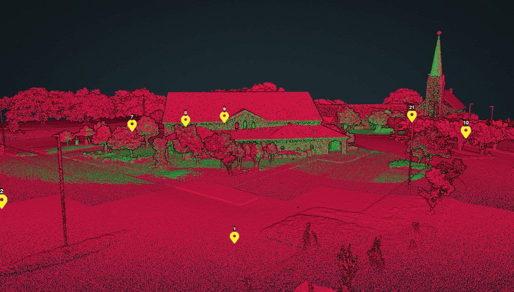
Speed: Walking pace for SLAM. 6 m/s UAV flight
Point density: thousands of points/m²
AGL: 80 during UAV flight
Acquisition time: ~2 hours
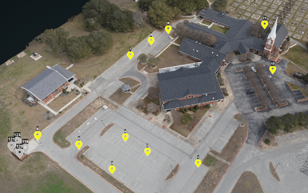
Speed: 6 m/s
Point Density: 200 points/m² per flight line
AGL: 120 m
Acquisition time: 10 minutes
Point Density: 510 points per m^2
Height: 80 m AGL
Speed: 6 m/s
Data Acquisition Time: 3 minutes
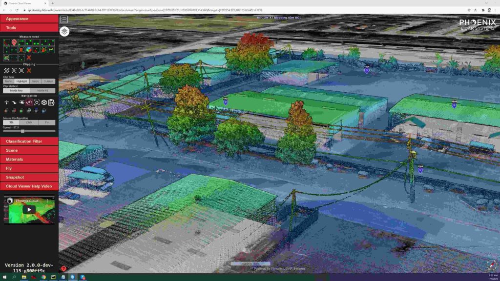
LIDAR, which stands for Light Detection and Ranging, has become a cornerstone in modern urban development. EHRA’s adoption of this technology, particularly the Mini-Ranger LIDAR system, showcases the significant advancements and efficiencies it brings to the field. The MiniRanger, known for its high-quality data collection, has been instrumental in EHRA’s ability to gather vast amounts of accurate data swiftly, transforming the landscape of urban engineering.
Discover the groundbreaking impact of LIDAR technology in urban development with EHRA’s innovative use of the Mini-Ranger LIDAR system. In this insightful video, we delve into how EHRA, a leading engineering firm, leverages the power of Drone LIDAR and the MiniRanger system to revolutionize urban planning and project management.

LiDAR technology, a groundbreaking innovation in the realm of surveying and remote sensing, has been a game-changer for many industries. With its ability to provide accurate and detailed data, it’s no wonder that professionals and organizations are rapidly adopting this technology. Among the most notable advancements in this field is the use of drones for LiDAR. This video delves deep into the environmental and technical challenges faced in drone-based LiDAR, drawing insights from industry experts James Kessner and Aaron Handl of Encompass Services.
Evolving the Capabilities of LiDAR
With the introduction of the RECON series, Phoenix LiDAR Systems is removing barriers to widespread LiDAR remote sensing adoption. The RECON series combines low-cost hardware with Phoenix LiDAR Systems industry leading software, LiDARMill, and is empowering a new generation of professionals like never before.
The RECON series features higher accuracies than competing products (that are based on Applanix or DJI navigation systems), while offering extremely simple, automated post-processing solutions to extract maximum value from each dataset.
Utilizing the LiDARMill online, automated processing platform, raw datasets can be imported straight from a USB drive, with reference and optional ground control data seamlessly integrated. Simple wizards enable advanced processing options like trajectory optimization, LiDAR and camera calibration, AI classification, smart decimation and the creation of high-quality deliverables (contours, DTM/DSM/CHM, pointcloud tiling etc.). A fully registered, colorized pointcloud is produced that is accurate in both relative and absolute terms. Project reports then summarize project performance and verify system accuracy.
Phoenix Lidar Systems is committed to designing the world’s most advanced, complete LiDAR solutions. With the RECON + LiDARMill combination, users can deploy a simple toolkit that is able to derive accurate and reliable datasets in a matter of hours. Powerful, affordable, and comprehensive…the RECON series by Phoenix Lidar Systems is now available, and sure to disrupt the remote sensing industry.
UAV and LiDAR have transformed the surveying industry by offering large area mapping at scale. In this month’s webinar Phoenix Lidar Systems we explore the process, strengths, and limitations of aerial surveying with high performance LiDAR. Learn the basics and benefit from hearing from the real world experiences of Pape-Dawson Engineers as they review their decisions and experiences from launching a successful aerial LiDAR program.
This is a panel discussion featuring two Surveying and Engineering Design service providers: EHRA and Wood Rodgers. We will discuss how they are leveraging Phoenix LiDAR Systems to perform the heavy lifting in order to provide both the fastest data acquisition and best data deliverables to their clients. You won’t want to miss hearing their many compelling successes throughout their LiDAR-based Surveying and Engineering Design workflows.