
New Products
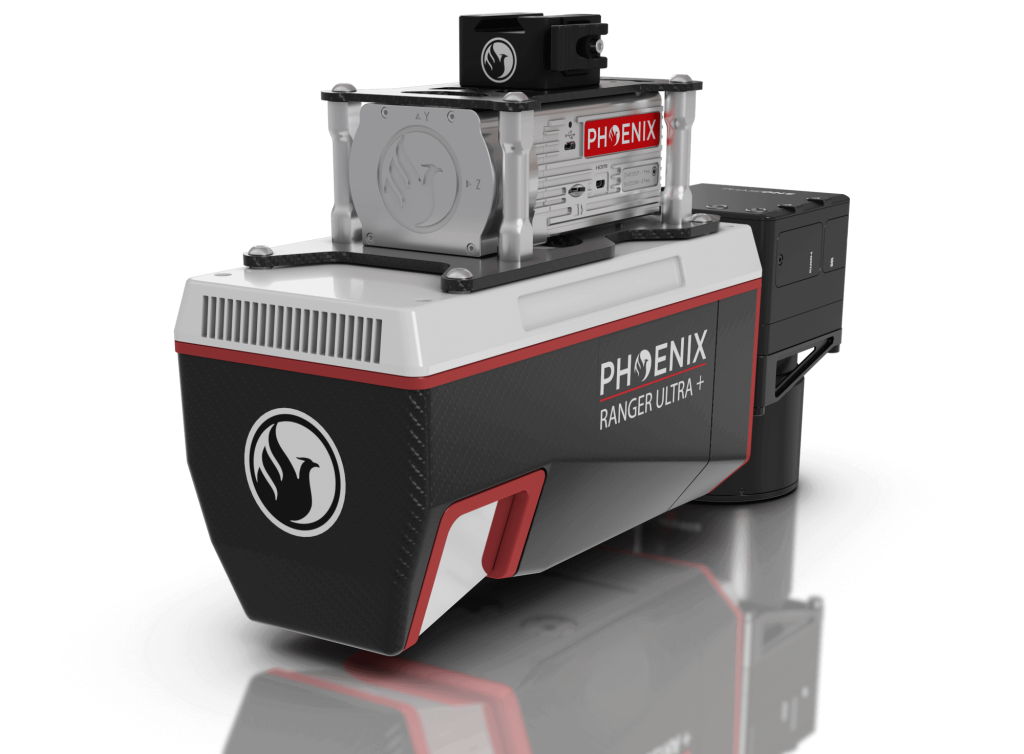
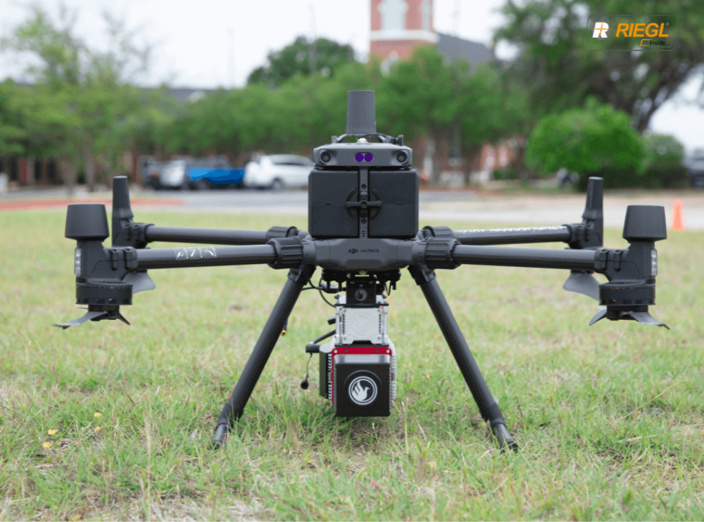
An Upgrade to the Renowned RANGER-ULTRA
RANGER-ULTRA+
The RANGER-ULTRA+ adds range and density capabilities to an already unrivaled mapping system.
The RANGER-ULTRA+ is a cutting-edge mapping system that offers a unique value proposition for professionals in a variety of industries. One of the system’s most innovative features is its forward and rear looking field of view, which minimizes laser shadowing and provides a high level of detail on vertical surfaces. This feature is especially useful for professionals who need to map infrastructure such as utility lines, railroads, and pipelines, where accurate vertical measurements are critical.
In addition to its advanced field of view, the RANGER-ULTRA+ also boasts pulse rates of up to 2.4 MHz, making it one of the fastest and most accurate mapping systems available today. This feature, coupled with the system’s ability to be carried by a variety of aircraft, makes it highly versatile and suitable for mapping at various scales to meet the unique project objectives of professionals in a range of industries.
Overall, the RANGER-ULTRA+ is an ideal tool for corridor mapping applications, such as utility, rail, and pipeline inspection. Its advanced features and versatility make it a valuable investment for professionals looking to maximize their mapping capabilities and achieve the highest level of accuracy and detail possible.
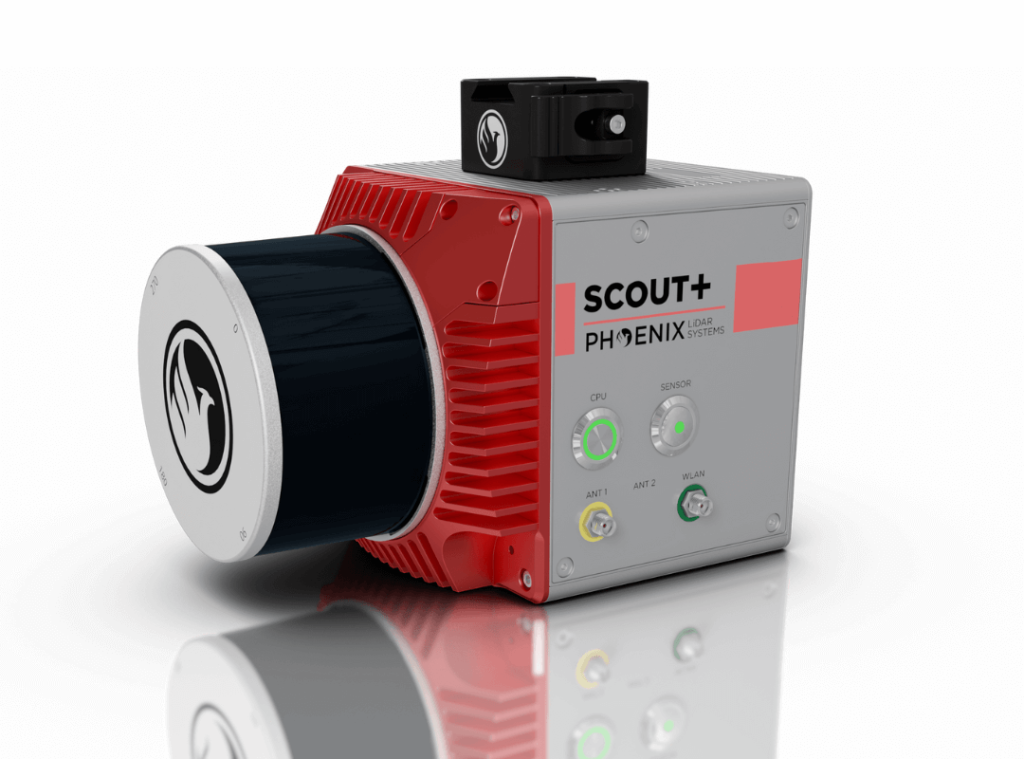
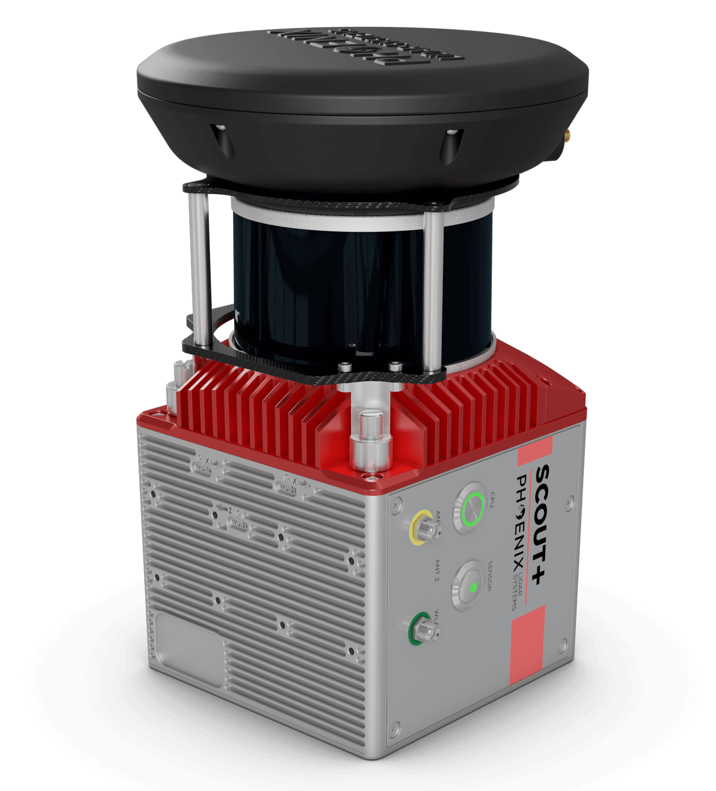
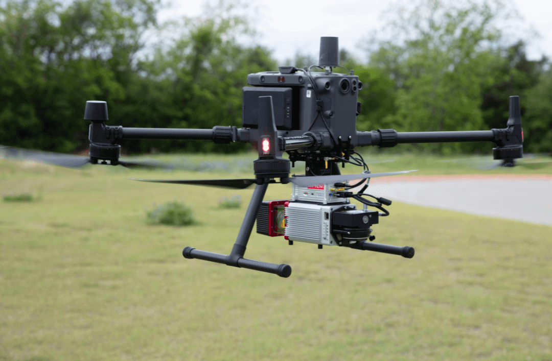
Our Newest LiDAR Mapping System is Here
SCOUT-M2X
A new level of precision and accuracy to the long trusted SCOUT lineup of multi-channel mapping scanners
The SCOUT-M2X is the ideal combination of performance, flexibility and affordability. It brings a new level of precision and accuracy to the long trusted SCOUT lineup of multi-channel mapping scanners.
Long range, high pulse rate and triple return capability allow for UAV acquisitions of more data faster through vegetation. Dense survey data can be collected by nearly any method: UAV, Mobile, Backpack, and more. The SCOUT-M2X is also SLAM capable, taking you where others cannot.
Benefits:
- Fast and accurate measurements with a 640 kHz pulse rate scanner
- Live control and feedback during acquisition, including Phoenix’s signature real-time point cloud
- SLAM (Simultaneous localization and mapping) capable
- Integrated high resolution camera options up to 61 mp
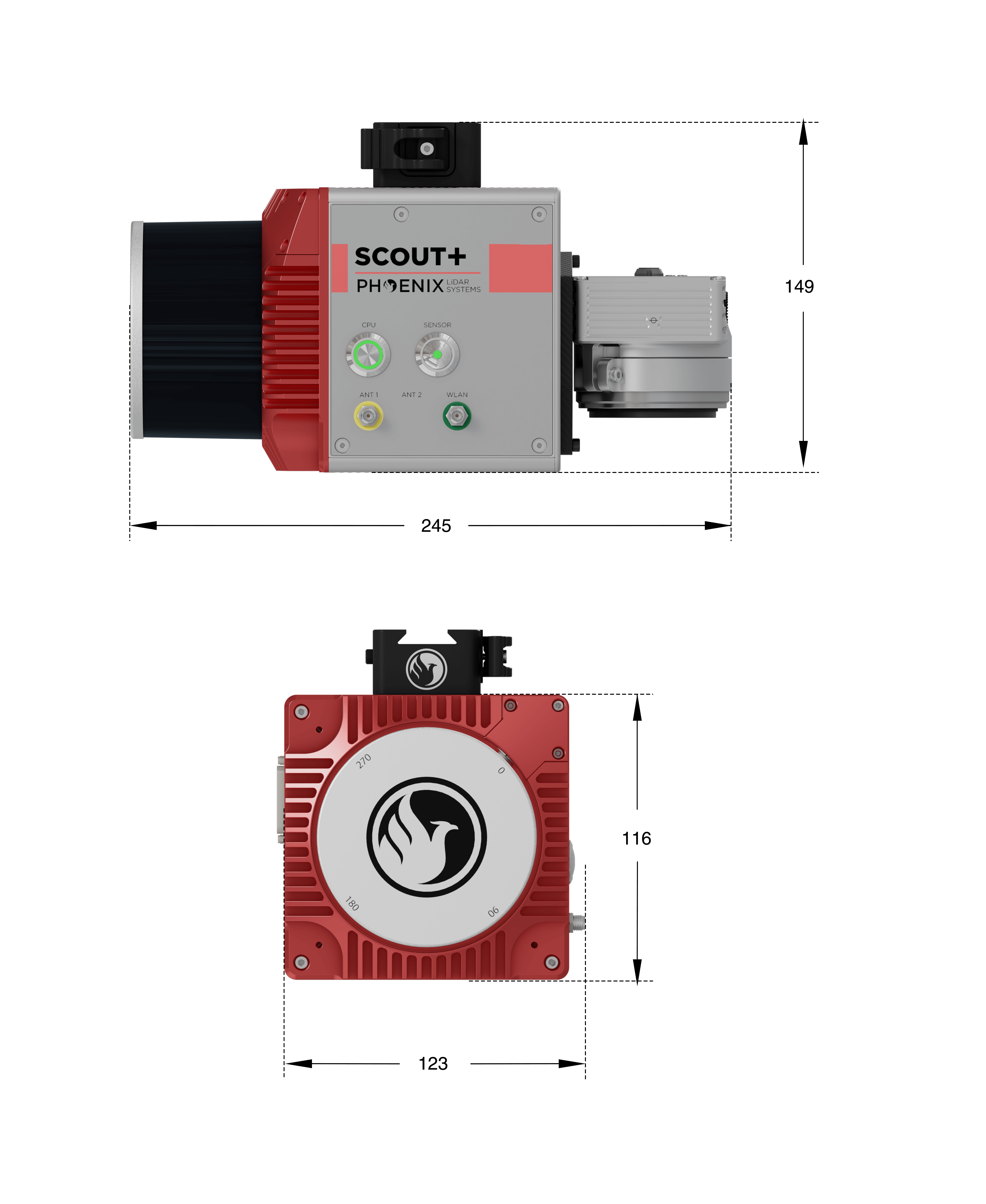
Specifications:
- Absolute Accuracy = 2-4 cm RMSEz @ 100m AGL
- Intraswath Precision = 4 cm RMSDz @ 100m AGL
- Weight = 1.8 kg
- Dimensions = 17.7 x 11.6 x 12.3 cm
- Pulse Rate = 640 kHz, Up to 3 returns
- Line Rate = 5,10 or 20 Hz
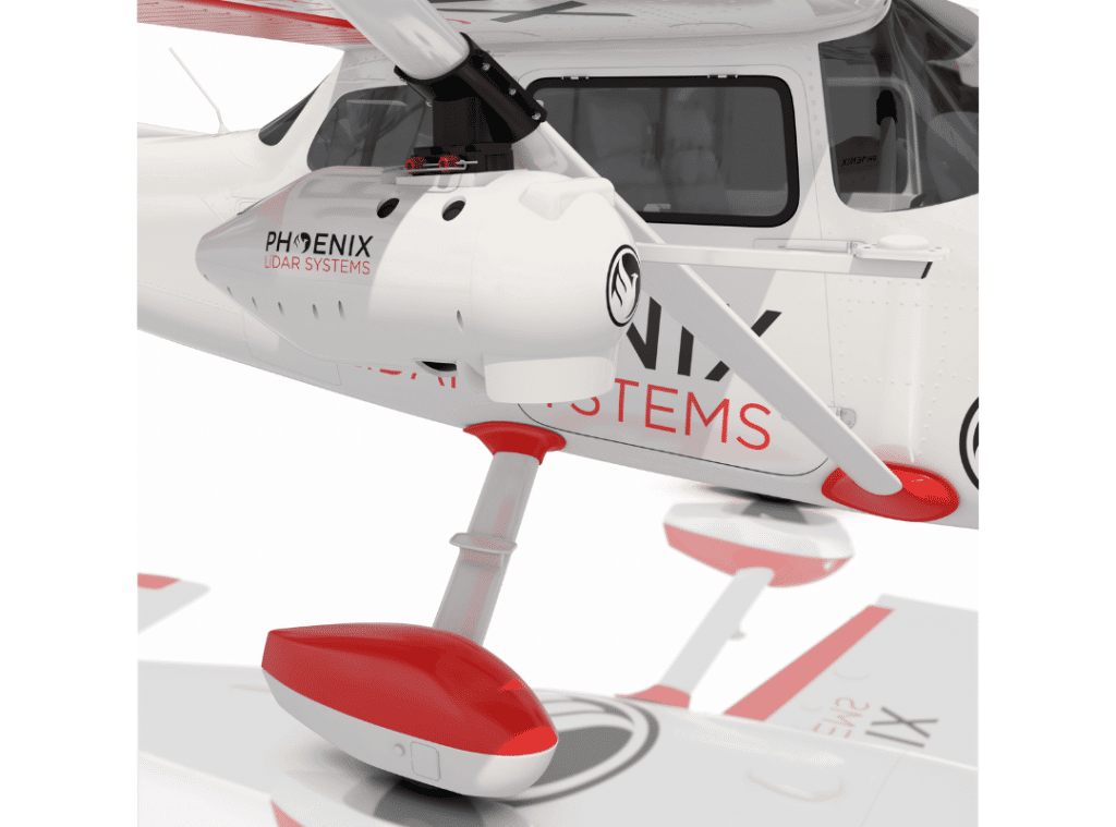
Enjoy a Light, Durable Cargo Pod, Aerodynamic and Efficient.
Looking to ensure your RANGER-XL LiDAR mapper is protected on its next mission? The Cessna Pod is the ultimate solution.
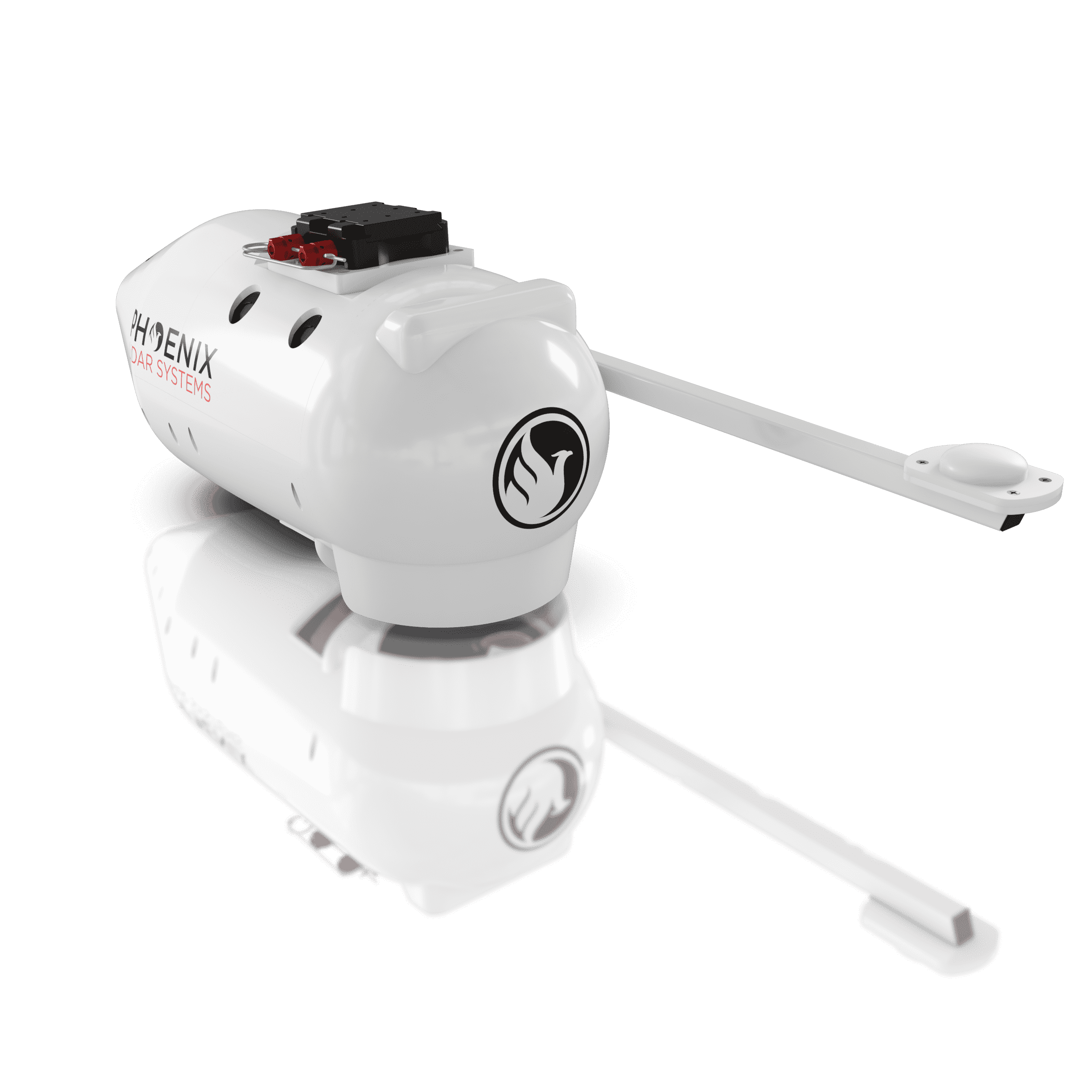
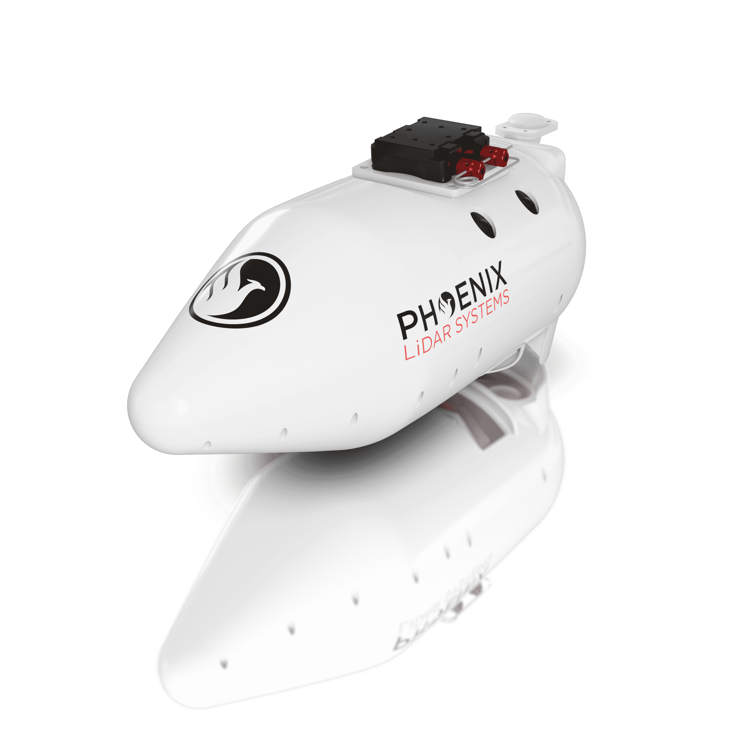
Elevate LiDAR Mapping with Our New Cessna Pod!
Leverage the sleek, aerodynamic pod for enhanced protection of your RANGER-XL. Seamlessly integrate on a variety of Cessna models – eliminating cumbersome installation and routing of an external GPS antenna.
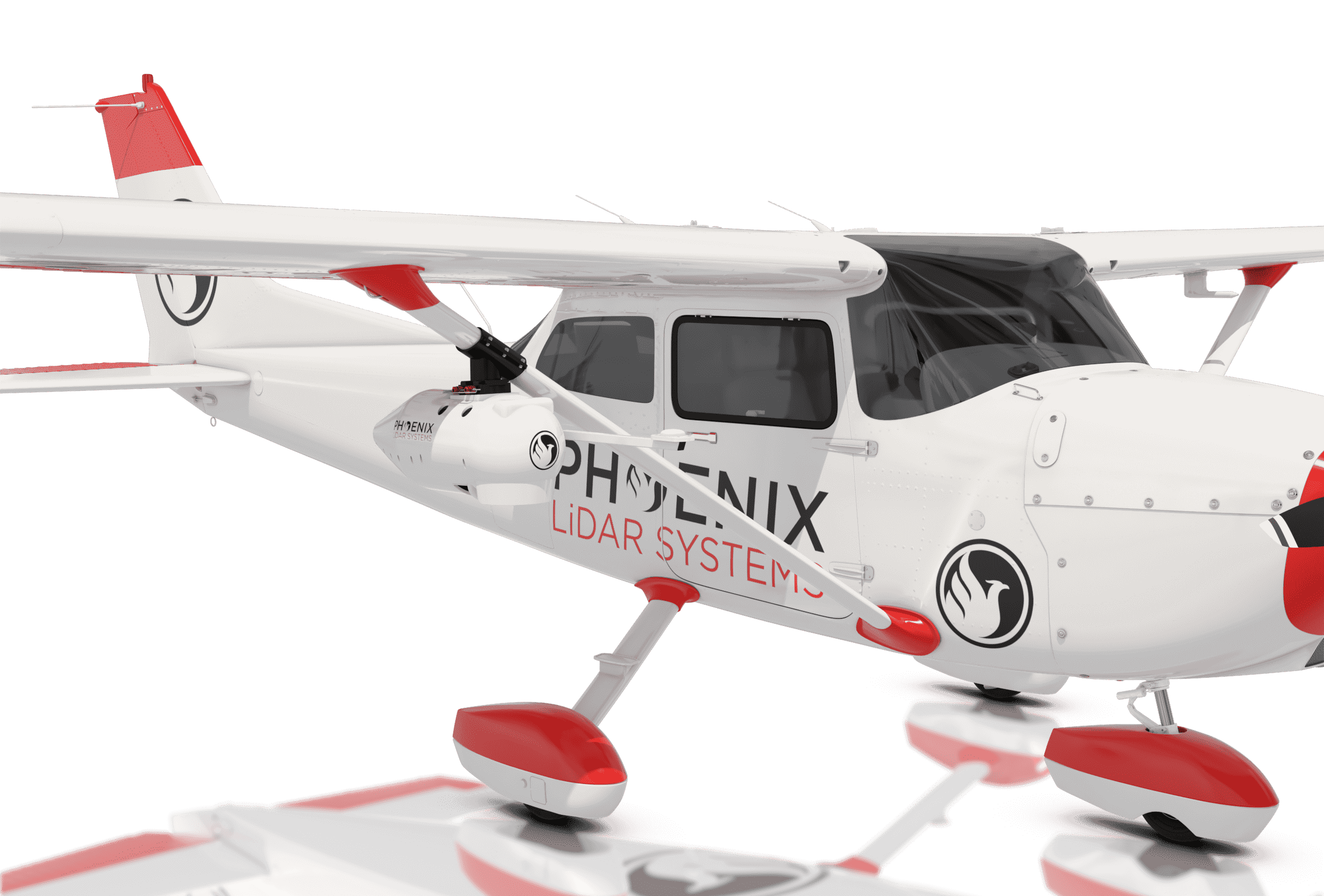
Reach out to our team to learn more about the advanced camera compatibility options!
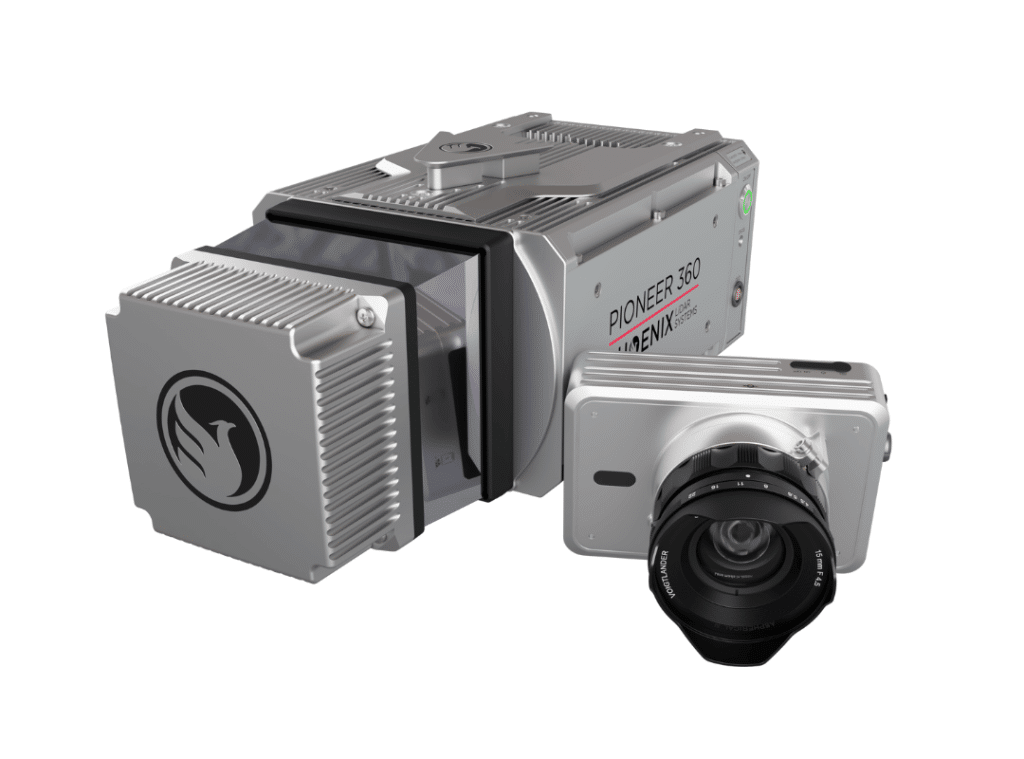
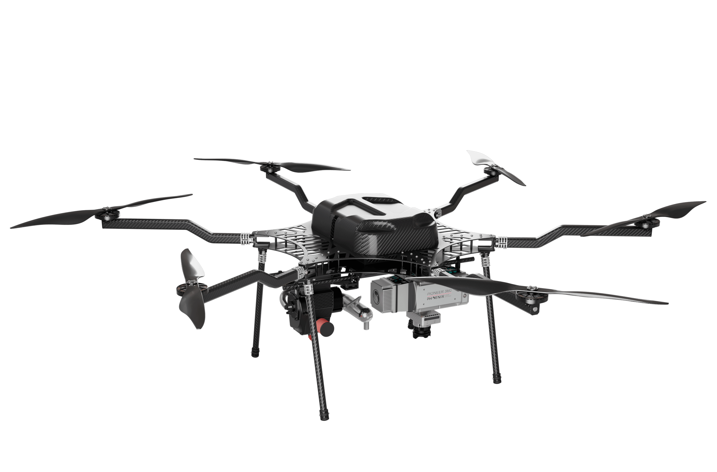
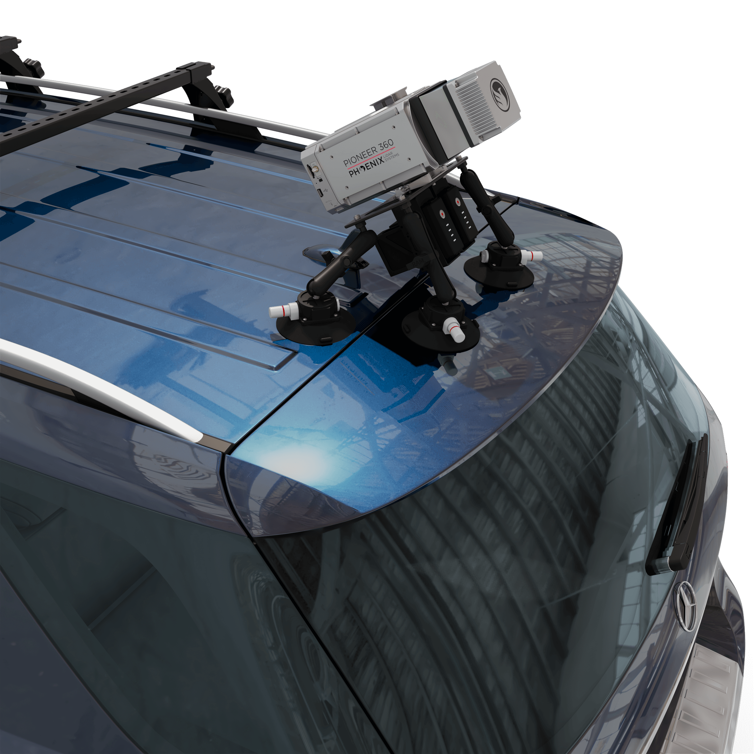
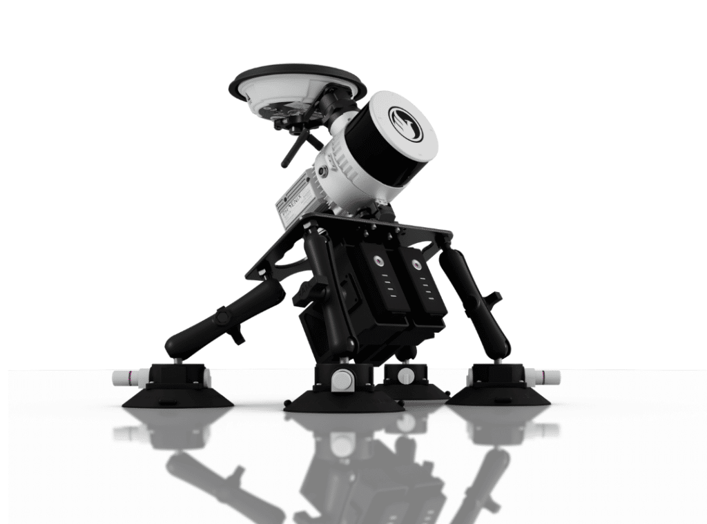
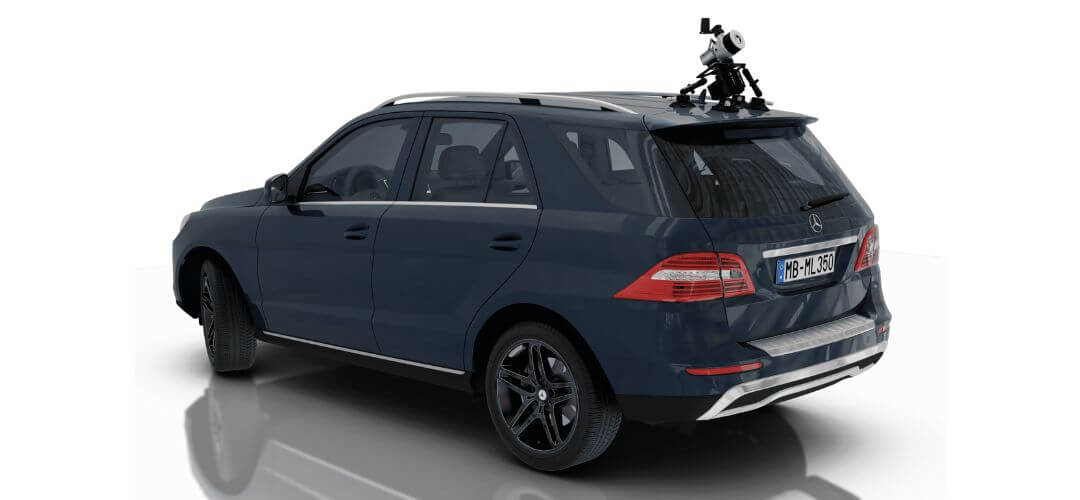
The PIONEER-360 is New and Improved!
The best-in-class universal survey grade LiDAR mapping system
The PIONEER-360 is the tool of choice for UAV and Mobile applications where there is no room for compromise in data quality. With a beam divergence of only 0.3 mrad, this system is designed for precision and confidence.
The PIONEER-360 supports selectable pulse repetition rates up to 500 kHz and line scan speeds up to 250 lines/second, allowing it to be optimized for various application and data requirements. A quick release system can accommodate a removable high-resolution, light-weight 61 MP camera.
Benefits:
- Most narrow beam divergence of any Phoenix LiDAR system for superior ground detection and canopy penetration
- Even point distribution at higher vehicle speeds
- Price and performance closes the gap between MiniRANGER and RANGER series systems
- Highly adaptable – capable of UAV, mobile, and backpack applications

Specifications:
- Narrow beam divergence of <0.3 mrad 1/e
- Shot-to-shot precision of <1cm for survey applications
- Up to 4 returns
- Laser Range: 290 m @ 20% Reflectivity
- Scan Rate: Up to 500 kHz
- Weight: 4.9 kg / 10.8 lbs including camera
- Scan speed of 250 lines per second
- 61 MP camera (optional)
PIONEER-360 is Mobile Mapping Compatible!
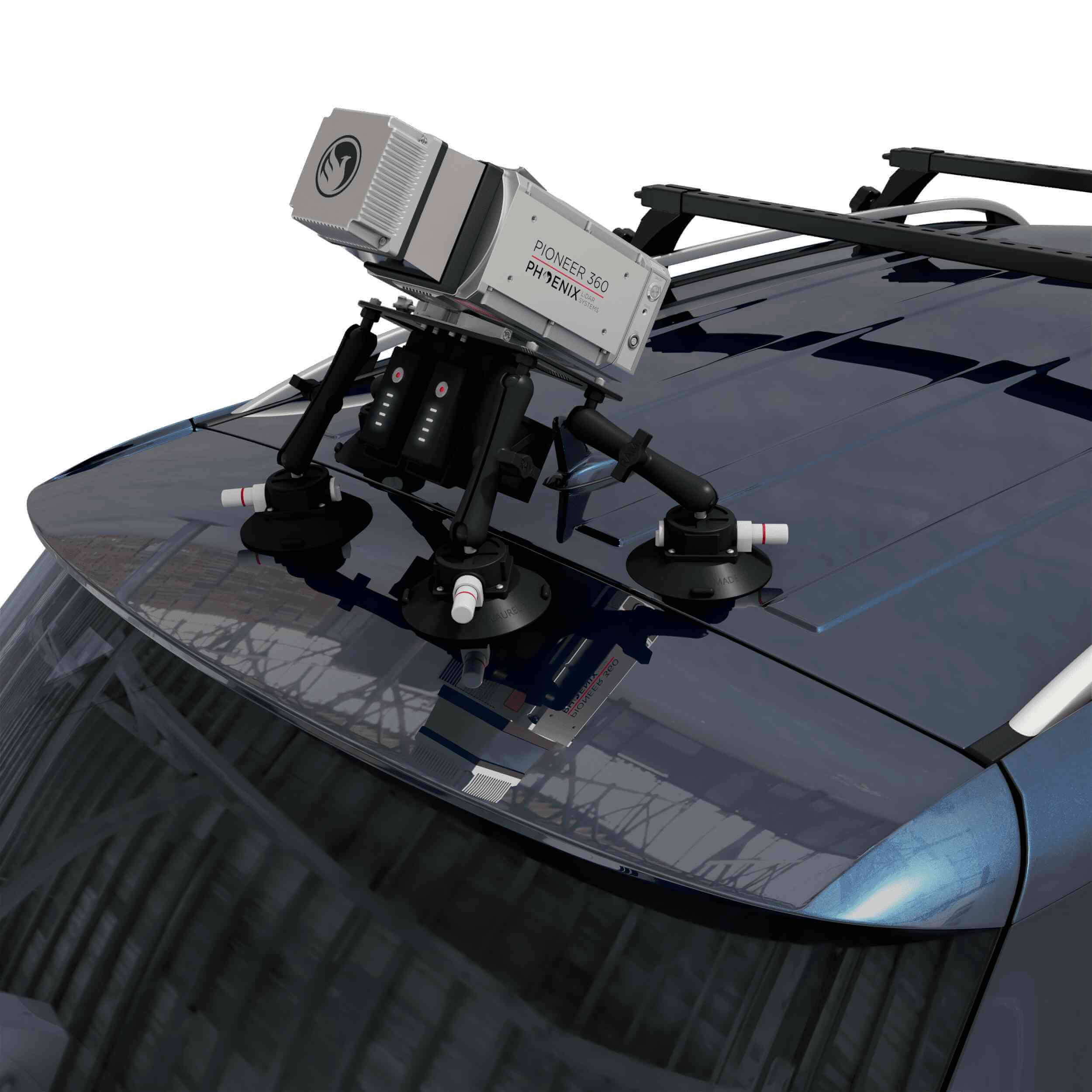
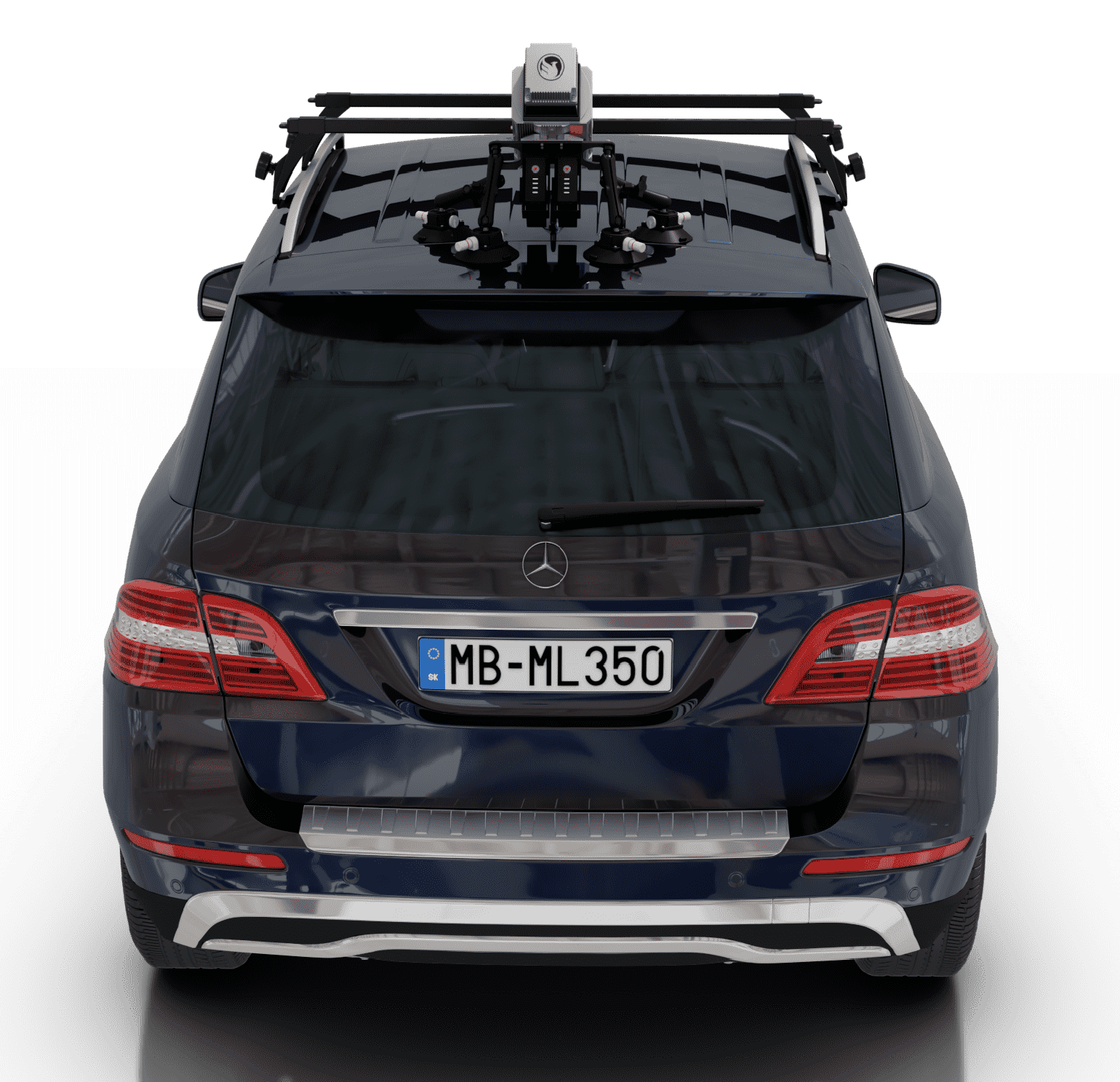
RECON-XT Now Mobile-Mapping Compatible with the Release of Our Universal Suction Mount!
Does your LiDAR system work seamlessly between UAV and mobile mapping-applications? The RECON-XT does. Why choose?
The RECON-XT is a breakthrough technology in complete LiDAR solutions. The system is capable of survey-grade accuracies, dense vegetation penetration, while retaining a minimalist, light-weight profile. While initially designed for seamless integration with the DJI M300 RTK airframe, Phoenix LiDAR Systems has made the RECON-XT compatible with a wide array of commercially available UAV.
Now, with the introduction of the Mobile Mapping Kit for RECON-XT, users can take their system from air to ground vehicle in a matter of minutes, giving operating teams the ability access to more data, more applications, and more versatility than ever before.
Request More Information
When coupled with Phoenix Software LiDARMill and Spatial Explorer software, users can take advantage of industry leading data processing functions that drive automated workflows, quality control, reporting, deliverables, and remote viewing capabilities to even the most novice of LiDAR users.
If you’re looking for an accurate, fast, lightweight, and versatile LiDAR system that is dependable and easy to use, the RECON-XT is one of the best choices available. We invite you to take a look at the sample data here, and contact our team for more information.
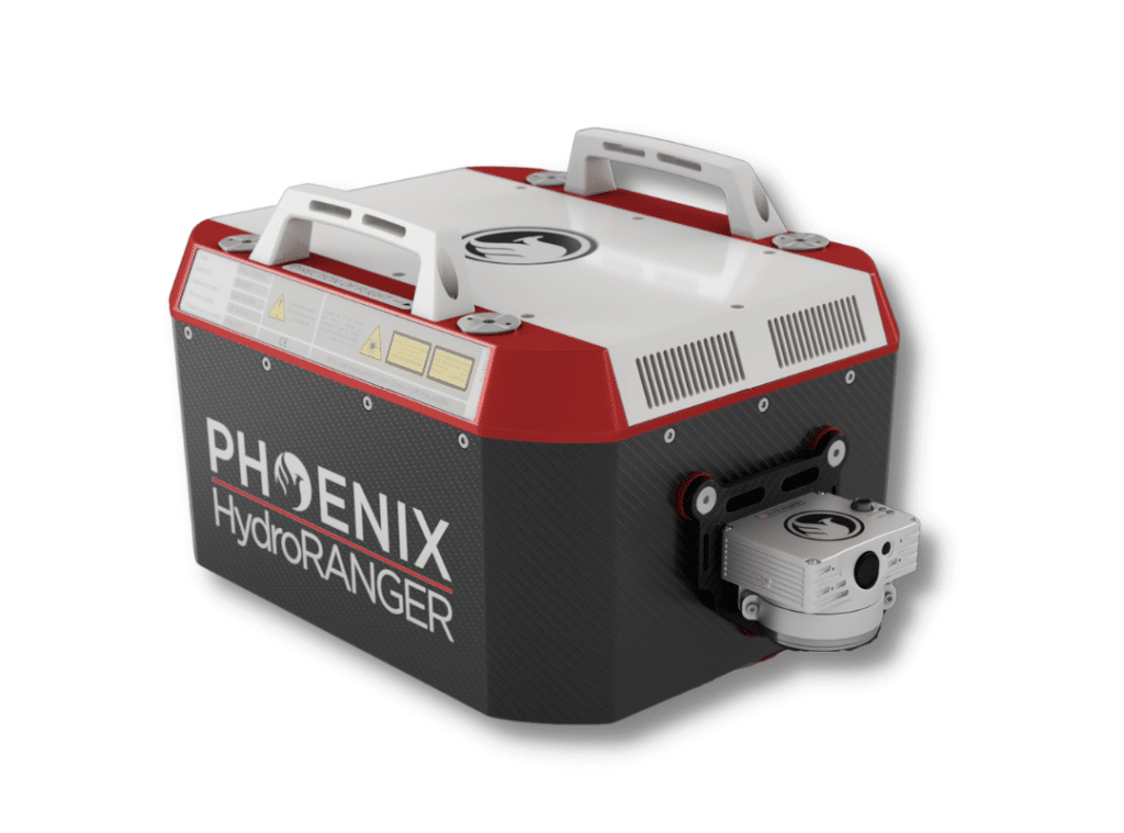
Now more than ever, there is an urgent need for consistent bathymetric mapping in highly dynamic coastal shorelines. To fulfill this industry-wide need, Phoenix LiDAR Systems has decided to offer the ultimate high-resolution land/water interface mapping solution!
Near-shore topobathymetric digital elevation models are essential for navigation and ocean science and imperative for a wide range of applications; from studying the effects of climate change and generating hydrodynamic models to creating nautical charts and assisting in coral habitat conservation.
The Phoenix LiDAR HydroRANGER provides dual purpose topographic and bathymetric measurements for full scene mapping of shoreline systems. Utilizing a visible green spectrum laser with an elliptical scan pattern and measurement rates up to 200 kHz, the HydroRANGER provides a combination of high spatial resolution and spatial accuracy. Capable of reaching beyond 2 Secchi depths, this is the ideal solution for mapping land-water interface environments along rivers, reservoirs, oceans and more!
Watch the HydroRANGER in Action
MiniRANGER-3 LITE Now M300 Airframe Compatible
The complete UAV LiDAR mapping solution
The moment you have all been waiting for is here! Phoenix LiDAR Systems is proud to announce the most powerful M300 compatible payload on the market – the MiniRANGER-3 Lite!
We combined Reigl industry leading laser precision with the ubiquitous M300 airframe, and topped the solution off with Phoenix LiDAR Systems’ renowned real-time 3D data visualization software.
This package provides the next generation of mapping professionals with a compact and cost-effective tool that leverages the highest number of target echoes per laser shot offered by any M300 payload.
The MiniRANGER-3 LITE and DJI M300 package provides the next generation of mapping professionals with a compact and cost-effective tool that leverages the highest number of target echoes per laser shot offered by any M300 payload.
MiniRANGER-3 LITE:
- 15mm measurement range accuracy
- Selectable 100 kHz, 200 kHz, 300 kHz laser pulse repetition rate (PRR) » Modular and upgradable system for maximum project flexibility
- Multiple target capability – up to 5 target echoes per laser shot M

DJI M300 RTK:
- Safe and Reliable platform packed with redundancy features
- Integrated drone health management system
- Change batteries without powering down
- Improved flight display