
Product Highlight Videos
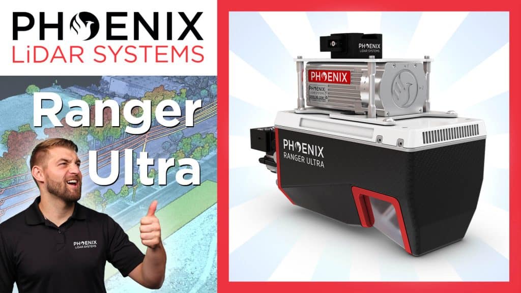
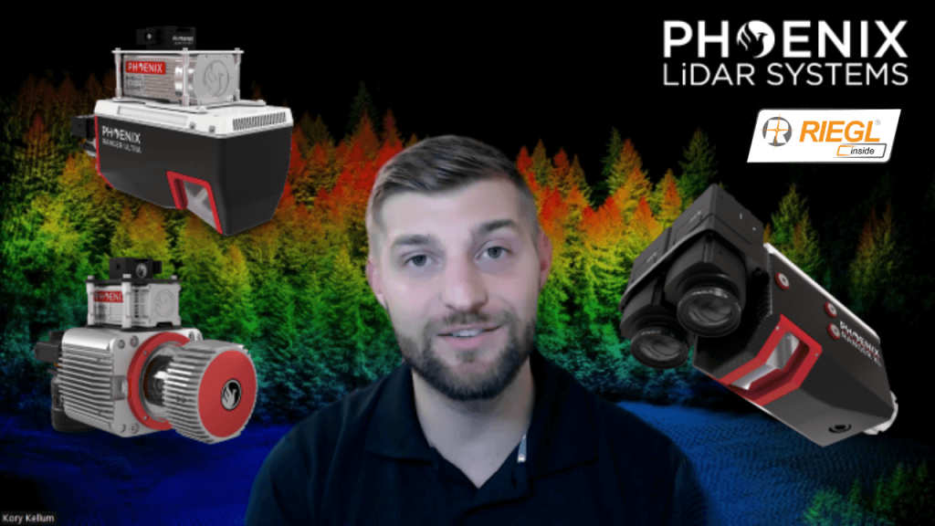
Phoenix LiDAR Systems RANGER-ULTRA – Product Spotlight
The RANGER-ULTRA from Phoenix LiDAR Systems is unmatched in performance and versatility. It is lighter than other similar systems and works for crewed and uncrewed missions. It is well suited for the most demanding mapping missions including power line, railway, pipeline, topography, open-cast mining, urban applications, archaeology, cultural heritage documentation, agricultural, forestry, and much more!
In this video, Kory Kellum of Phoenix LiDAR Systems takes us through the features and uses of the RANGER-ULTRA.
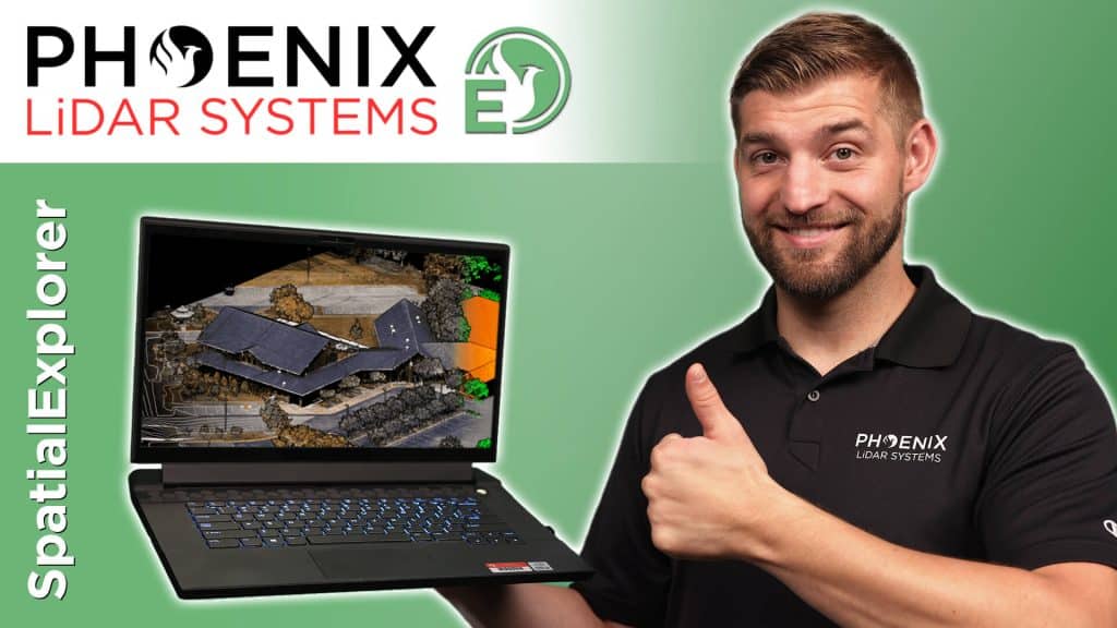
What Is The Best LiDAR Processing Software?
If you are looking for the best LiDAR processing software, look no further because Phoenix LiDAR Systems has you covered! In this video, Kory Kellum of Phoenix LiDAR Systems tells you how to deliver the highest quality LiDAR and data deliverables possible. This video covers the highlights of SpatialExplorer (or SE for short) and ways to use it effectively.
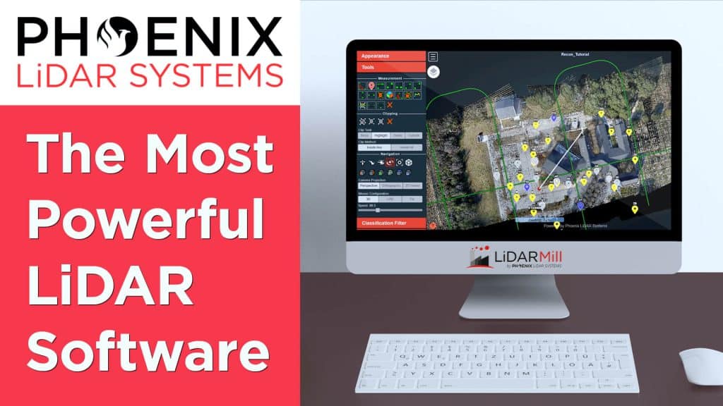
The Most Powerful and Easy To Use LiDAR Software – LiDARMill from Phoenix LiDAR Systems
LiDAR processing can be complicated, expensive and slow. But there is a great solution from Phoenix LiDAR Systems – LiDARMill. The cloud based software that can help you process LiDAR data quickly, accurately and inexpensively. And LiDARMill makes it easy to share LiDAR data with anyone. In this video, Kory Kellum of Phoenix LiDAR systems explains what LiDARMill is, who it’s for, and how you can try it for free!

Phoenix RANGER-LR: The Universal LiDAR System
If you are looking for the most adaptable LiDAR system in the world, then you’ve come to right place! The RANGER-LR from Phoenix LiDAR is considered to be the “Universal Soldier” of LiDAR mapping systems. The RANGER-LR can be flown on a number of aerial and ground platforms. In this video, Kory Kellum of Phoenix LiDAR Systems explains why the RANGER-LR may be the right solution for your LiDAR mapping needs, no matter what they are.
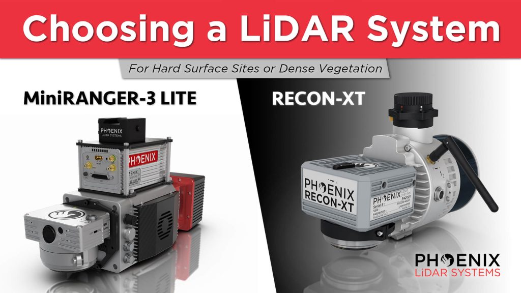
The Best DJI M300 UAV LiDAR Solutions – RECON-XT & MiniRANGER 3
If you are looking for a high-performance yet light weight solution, the RECON-XT and MiniRANGER-3 are both versatile and affordable LiDAR solutions. They are both mountable on the DJI M300 UAV. They are both survey grade solutions featuring high-precision. The biggest difference is that one relies on a single, high-powered laser, and the other relies on multiple lasers. The MiniRANGER-3 features an impressive recommended AGL of up to 75 meters, filling a major AGL gap in the ultra-lightweight UAV LiDAR market. And the RECON-XT is the ultimate value, entry-level system for the DJI M300. A strong fit for smaller scan areas and teams on a budget.
How to Choose the Right System for Long Range LiDAR Mapping
Kory Kellum with Phoenix LiDAR Systems helps you choose the right tool for the right job when it comes to high altitude lidar mapping, with an in depth product review of The RANGER Series. The RANGER-XL, RANGER-Ultra and RANGER-LR are all top performers when it comes to precision, accuracy, long ranging capability, and point density; However, the intrinsic differences in their technologies should be explored to understand how those differences warrant the use of one over the other for certain applications.
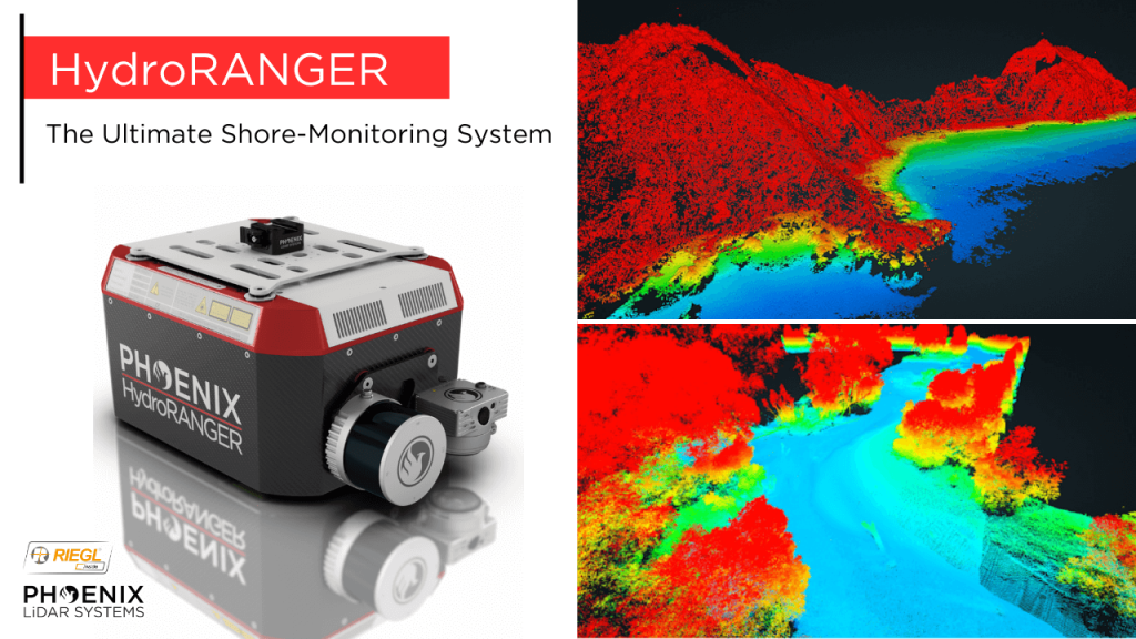
The Ultimate Shore Mapping LiDAR Solution – Phoenix LiDAR Systems’ HydroRANGER
The HydroRANGER is an evolution of mapping technology. This airborne topo-bathymetric (ATB) system provides dual purpose topographic and bathymetric measurements for full scene mapping of shoreline systems. Utilizing a visible green spectrum laser with an elliptical scan pattern and measurements rates up to 200 kHz, the HydroRANGER provides a combination of high spatial resolution and spatial accuracy. Capable of reaching beyond 2 Secchi depths, this is the ideal solution for mapping land-water interface environments, rivers, reservoirs, oceans, and more!
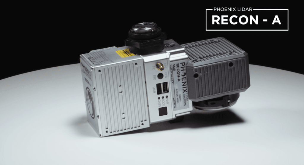
Phoenix LiDAR RECON-A: The Lightest, Most Cost-Effective LiDAR System on the Market
The Phoenix RECON-A is the ideal solution for reconnaissance mapping missions such as vegetation encroachment on powerlines. This all-in-one payload offers ease of use and efficient data collection all at an affordable price point.
The RECON-A maximizes point cloud density by utilizing it’s multi-pattern laser to pick up even the lowest reflective points. The integrated 24 MP high resolution camera has the same FOV as the LiDAR sensor yielding maximum RGB colorization of the point cloud.