
Ranger-LR

This user manual provides a detailed overview in the use of our LiDAR mapping systems. It addresses and explains the working principles of the underlying components, the system architecture, and the required software. This manual is not intended to replace customer training. Instead, it should serve as introductory material for new users and a reference tool for experienced personnel. Use the link below to access the wiki.
Point Density: 16,700 points per m^2
Height: ~1.5m AGL
Speed: Walking pace (~3-4 mph)
Data Acquisition Time: 12 minutes
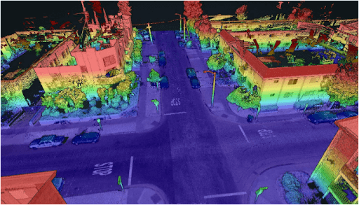
Point Density: 3920 points per m^2
Height: 2 m AGL
Speed: ~20 mph
Data Acquisition Time: 10 minutes
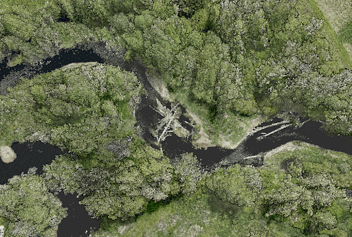
Point Density: 610 points per m^2
Height: 70 m AGL
Speed: 5 m/s
Data Acquisition Time: 26 minutes
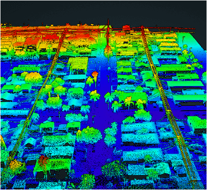
Point Density: 9200 points per m^2
Height: 20 m AGL
Speed: 6 m/s
Data Acquisition Time: 10 minutes
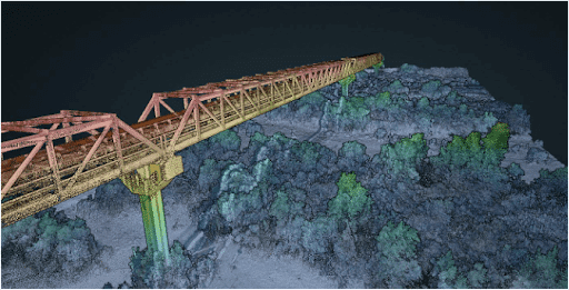
Point Density: 320 points per m^2
Height: 80 m AGL
Speed: 8 m/s
Data Acquisition Time: 7 minutes
Are you tired of sifting through endless options and specifications to find the right drone lidar sensor for your needs? Look no further! Our comprehensive selection guide takes the guesswork out of the process, helping you make informed decisions about which sensor is best suited for your project.
Our guide offers a detailed overview of the key features and benefits of various drone lidar sensors, including their range, accuracy, and data output capabilities.
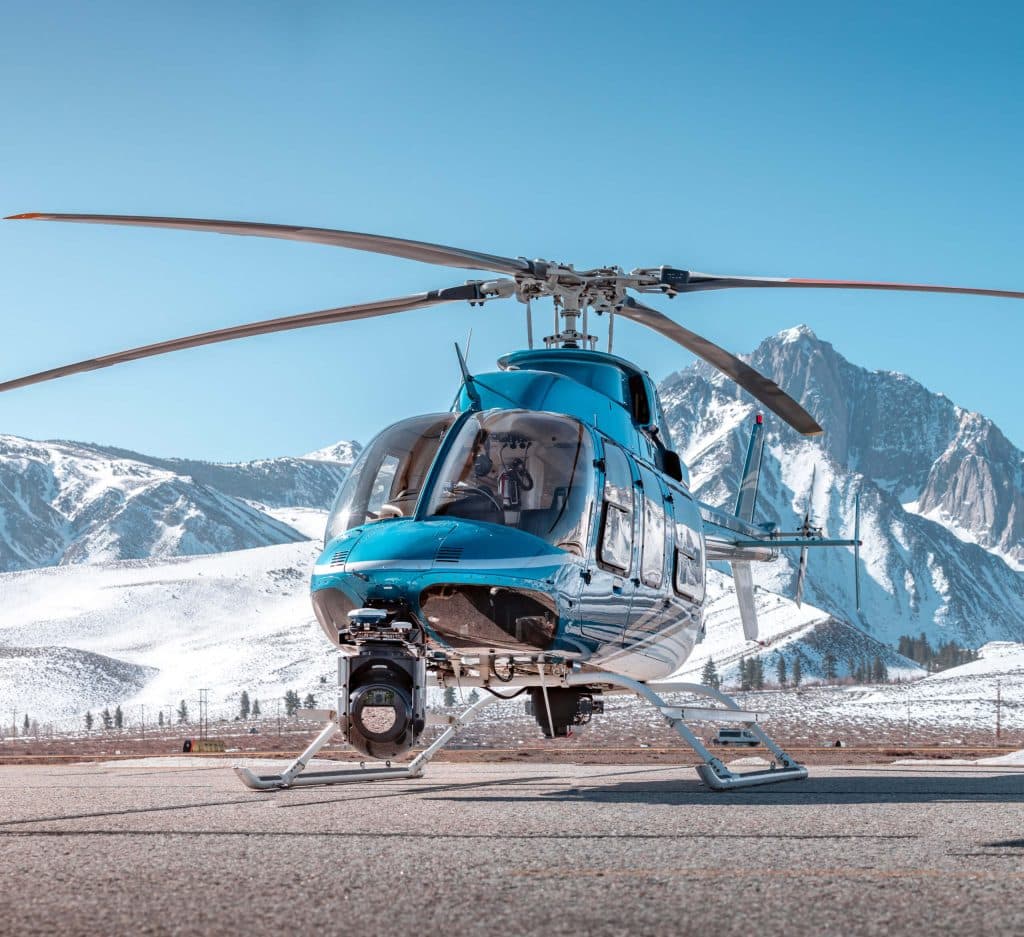
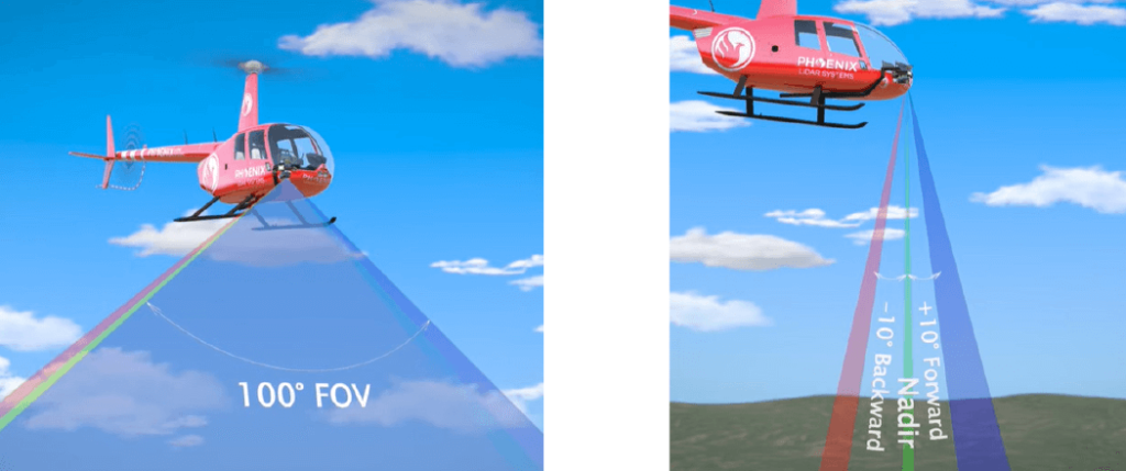
Join us as we sit down with SkySkopes for an in depth discussion focused on helicopter based mapping solutions. SkySkopes is a top-tier data service provider. Their team operates a wide variety of advanced sensors and aircraft for transmission and distribution line inspections, oil and gas applications, and many other innovative use cases that focus on adding value.
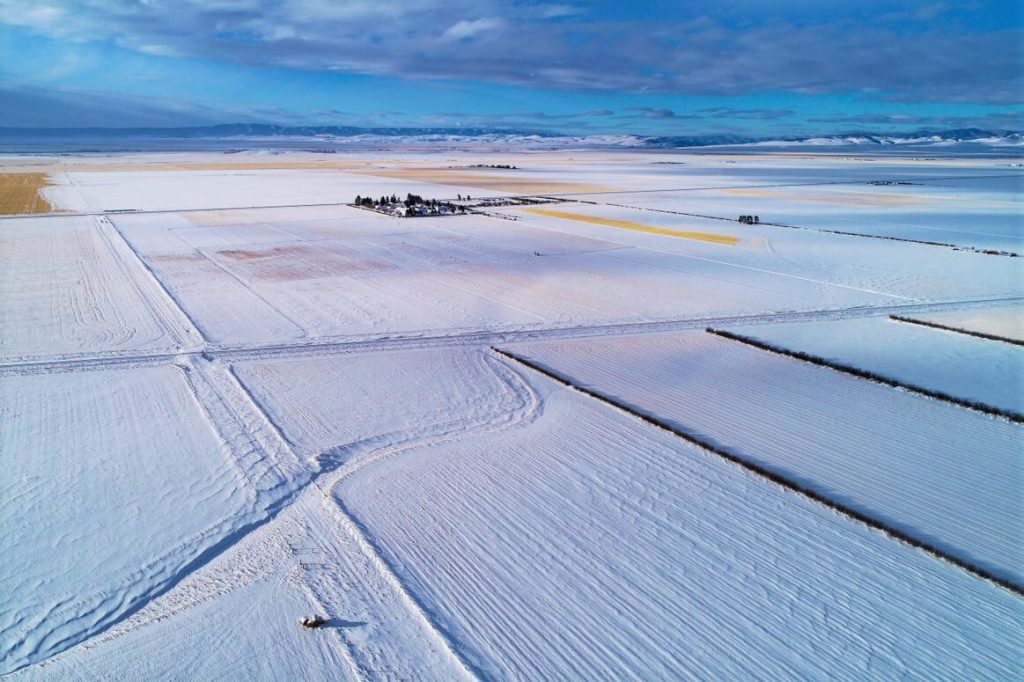
Join us for an intriguing webinar alongside Jeff Rizza of DJ&A to explore a unique UAV LiDAR project they completed for NASA and MSU earlier this year! As a contributor to the NASA SnowEx program, DJ&A used a Phoenix LiDAR system to capture highly detailed point clouds of snow surfaces that will be used by scientists for snow dynamics research. You won’t want to miss this one! Stick around until the end for a sneak peak on DJ&A’s upcoming white paper comparing UAV LiDAR and photogrammetry for topographic mapping!