
Webinar
Interested in generating survey grade data with greater automation? How about with more control, less time, and more accurate results? Phoenix LiDAR Systems is excited to showcase LiDARSnap 4 to accomplish all of this and more! This webinar presents the factors involved in the creation of quality point cloud data from systemic boresight calculations to mission-specific LiDAR calibration including trajectory optimization and adjustment to ground control. Through combining all LiDAR calibration approaches into an automated, user-friendly tool, LiDARSnap 4 saves the user time, greatly reduces the complication of point cloud calibration, and improves the overall accuracy of the end deliverable! See how Phoenix LiDAR Systems has streamlined the path from acquisition to actionable survey grade point cloud data through the ease of LiDARSnap4!
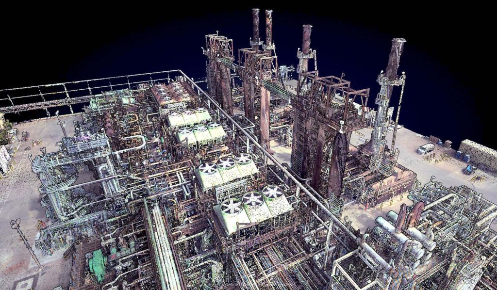
This webinar features two fascinating Phoenix clients who are delivering impressive data within the oil and gas space: Measurement Sciences, Inc. (MSI) and Precision Aerial Compliance Solutions. We will discuss some of their many compelling successes throughout their LiDAR-based oil and gas workflows. MSI will give an inside look into pipeline mapping while Precision Aerial will focus on their Refinery Expansion work.
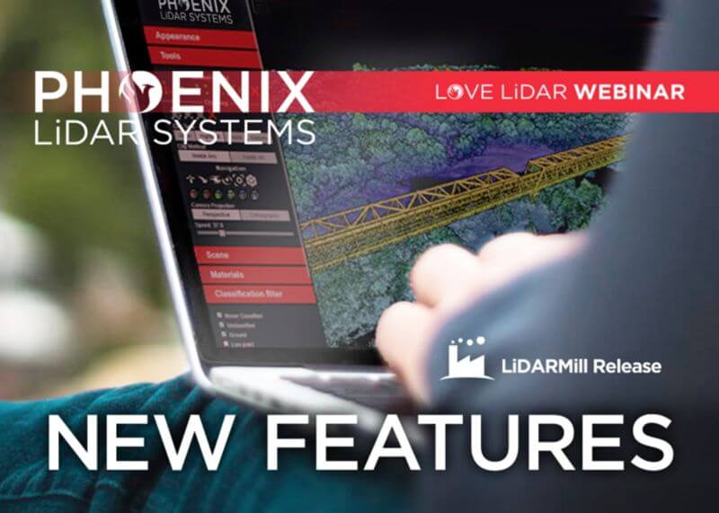
In this month’s webinar, we discuss some new and exciting developments and improvements in our automated processing software, LiDARMill.
In the presentation, we cover cloud processing project setup and highlight some of the major changes, including:
- A new coordinate reference system wizard
- Updated GCP handling for user-friendliness
- Revised surveyed checkpoint accuracy reporting
- Tiled product output for easier data management
- Conveniently located user support documentation
- Improved system and dataset calibration with LiDARSnap v4
- Plus…a first look at our AI classification beta release that is now accessible to users!

Not all LiDAR sensors are created equal. Choosing a LiDAR payload for your application can be complex and confusing. There are many models with differing specifications and prices. Our goal is to help take the mystery out of selecting a LiDAR payload. We will examine the specifications that matter and show you how they impact data quality/efficiency in key application verticals like utility surveying, forested areas, and topographic mapping.
This is a panel discussion featuring two Surveying and Engineering Design service providers: EHRA and Wood Rodgers. We will discuss how they are leveraging Phoenix LiDAR Systems to perform the heavy lifting in order to provide both the fastest data acquisition and best data deliverables to their clients. You won’t want to miss hearing their many compelling successes throughout their LiDAR-based Surveying and Engineering Design workflows.

In this month’s webinar, we hosted Evan Hockridge, a Ph.D. student at Harvard University’s Davies Lab. We discussed how his team is leveraging LiDAR data and thermal imaging to map the African savanna in order to better understand how wildlife and wildfires reshape the natural landscape. Evan explained how wildlife of all sizes, from large elephants to tiny termites, reshapes the landscape and has a profound impact on the overarching ecosystem.
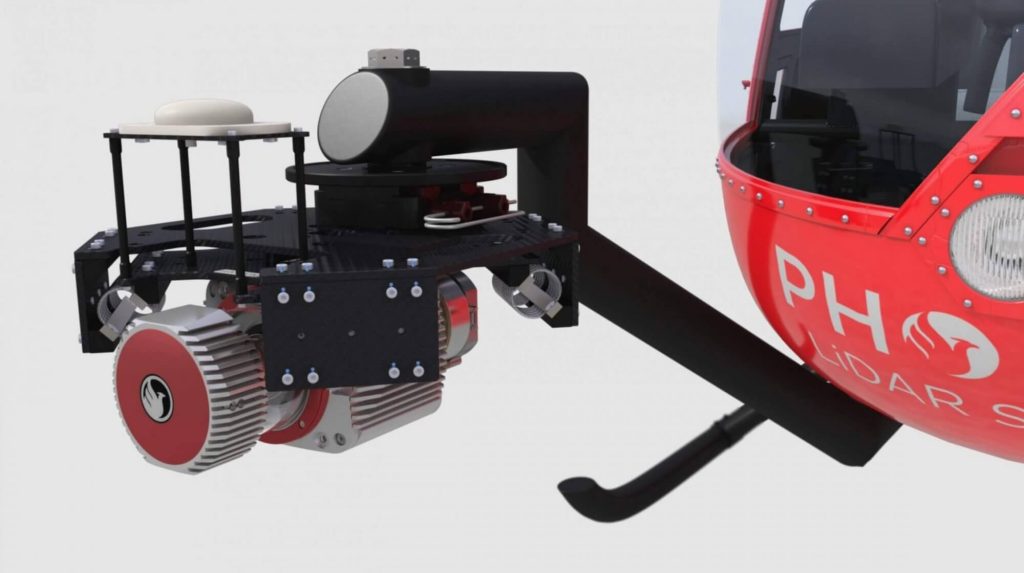
Join us for a discussion about how a single LiDAR Payload can suit many needs by being vehicle flexible. During the webinar, we will explain the technical considerations in both hardware and software for moving a system between platforms, the advantages of having a system that serves multiple purposes, and how advances in Phoenix LiDAR’s SpatialExplorer version 6 software reduce complexity and make swapping between platforms a breeze.
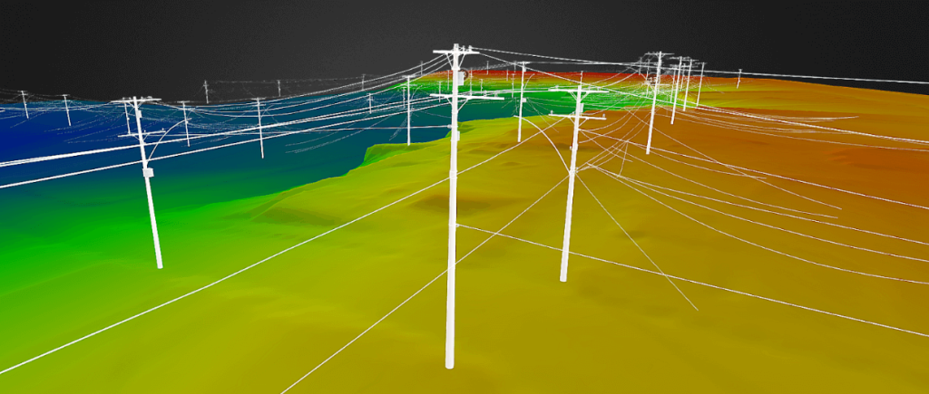
Watch this webinar for an in-depth case study of power line right of way aerial surveying! We’ll walk you through the entire process, from RFP analysis and Project planning to proper acquisition practices and actionable deliverables. Specific utility-focused processes will highlight the accurate, digestible data products available for end-users. Prepare to leave with a thorough grasp of all aspects of this profitable remote sensing application, plus a few tips and tricks to maximize efficiencies.
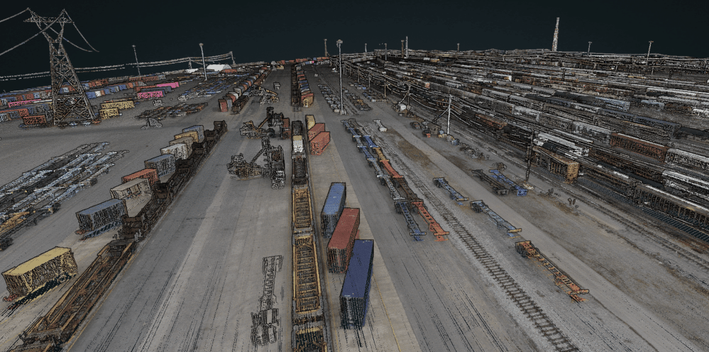
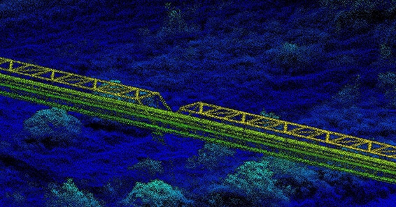
All aboard!! This was an exciting panel discussion featuring two fascinating Phoenix clients who are delivering impressive data within the rail space: CSX and American Rail Engineers/AirShark. We will discussed some of their many compelling successes, as well as a few lessons learned throughout their LiDAR-based rail workflows. CSX is one of the nation’s leading transportation suppliers of rail-based freight and intermodal containers, and continuously operate 7 Phoenix LiDAR Mobile-based systems every day! The team at ARE/AirShark prefers to take to the skies to service the transportation industry in over 30 states by utilizing a UAS-based Phoenix LiDAR system. So grab your ticket, climb on board, sit back and relax as we take you through another great webinar with some very special guests!