
Evolving the Capabilities of LiDAR
With the introduction of the RECON series, Phoenix LiDAR Systems is removing barriers to widespread LiDAR remote sensing adoption. The RECON series combines low-cost hardware with Phoenix LiDAR Systems industry leading software, LiDARMill, and is empowering a new generation of professionals like never before.
The RECON series features higher accuracies than competing products (that are based on Applanix or DJI navigation systems), while offering extremely simple, automated post-processing solutions to extract maximum value from each dataset.
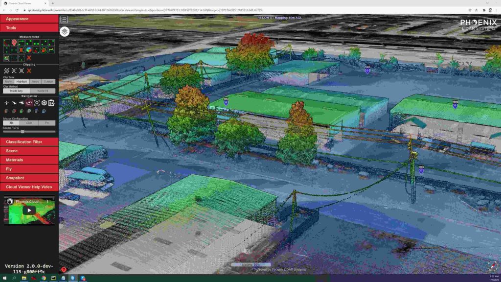
Utilizing the LiDARMill online, automated processing platform, raw datasets can be imported straight from a USB drive, with reference and optional ground control data seamlessly integrated. Simple wizards enable advanced processing options like trajectory optimization, LiDAR and camera calibration, AI classification, smart decimation and the creation of high-quality deliverables (contours, DTM/DSM/CHM, pointcloud tiling etc.). A fully registered, colorized pointcloud is produced that is accurate in both relative and absolute terms. Project reports then summarize project performance and verify system accuracy.
Phoenix Lidar Systems is committed to designing the world’s most advanced, complete LiDAR solutions. With the RECON + LiDARMill combination, users can deploy a simple toolkit that is able to derive accurate and reliable datasets in a matter of hours. Powerful, affordable, and comprehensive…the RECON series by Phoenix Lidar Systems is now available, and sure to disrupt the remote sensing industry.
