
LiDAR
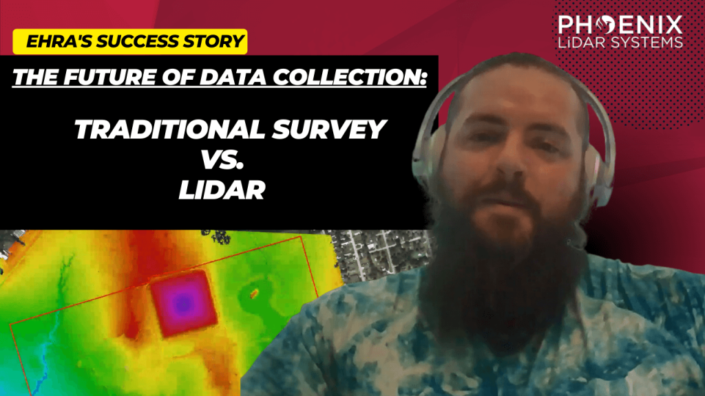
LIDAR, which stands for Light Detection and Ranging, has become a cornerstone in modern urban development. EHRA’s adoption of this technology, particularly the Mini-Ranger LIDAR system, showcases the significant advancements and efficiencies it brings to the field. The MiniRanger, known for its high-quality data collection, has been instrumental in EHRA’s ability to gather vast amounts of accurate data swiftly, transforming the landscape of urban engineering.

Discover the groundbreaking impact of LIDAR technology in urban development with EHRA’s innovative use of the Mini-Ranger LIDAR system. In this insightful video, we delve into how EHRA, a leading engineering firm, leverages the power of Drone LIDAR and the MiniRanger system to revolutionize urban planning and project management.

Unlocking the Power of Drone LIDAR: Transforming Transportation Projects. The world of transportation infrastructure is undergoing a profound transformation, and at the heart of this revolution is Drone LIDAR technology. This groundbreaking innovation is fundamentally reshaping the way we approach transportation projects, providing unparalleled precision and accuracy in high-precision mapping. In our comprehensive exploration, we delve into the captivating realm of Drone LIDAR. We start by unraveling the core concepts, introducing you to the technology’s essence, and highlighting why it’s becoming an indispensable tool in various industries.
LiDAR, which stands for Light Detection and Ranging, is at the forefront of reality capture technology. Pete Kelsey, with his profound expertise, delves into the essence of LiDAR and its unparalleled precision and accuracy. By integrating LiDAR with the Global Navigation Satellite System (GNSS), Pete crafts detailed digital representations of physical assets, many of which have never been digitized before.
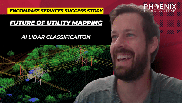
LiDAR technology, a groundbreaking innovation in the realm of surveying and remote sensing, has been a game-changer for many industries. With its ability to provide accurate and detailed data, it’s no wonder that professionals and organizations are rapidly adopting this technology. Among the most notable advancements in this field is the use of drones for LiDAR. This video delves deep into the environmental and technical challenges faced in drone-based LiDAR, drawing insights from industry experts James Kessner and Aaron Handl of Encompass Services.

LiDAR technology, a groundbreaking innovation in the realm of surveying and remote sensing, has been a game-changer for many industries. With its ability to provide accurate and detailed data, it’s no wonder that professionals and organizations are rapidly adopting this technology. Among the most notable advancements in this field is the use of drones for LiDAR. This video delves deep into the environmental and technical challenges faced in drone-based LiDAR, drawing insights from industry experts James Kessner and Aaron Handl of Encompass Services.
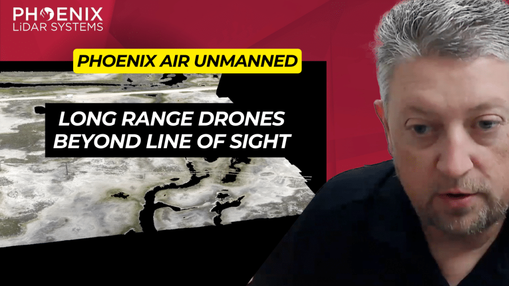
In the dynamic realm of aviation, few have risen as swiftly and impressively as Phoenix Air Unmanned. This video delves deep into the journey of Phoenix Air Unmanned, a trailblazer in drone operations, and its unwavering commitment to setting new benchmarks in the industry. Introduction to Phoenix Air Unmanned.
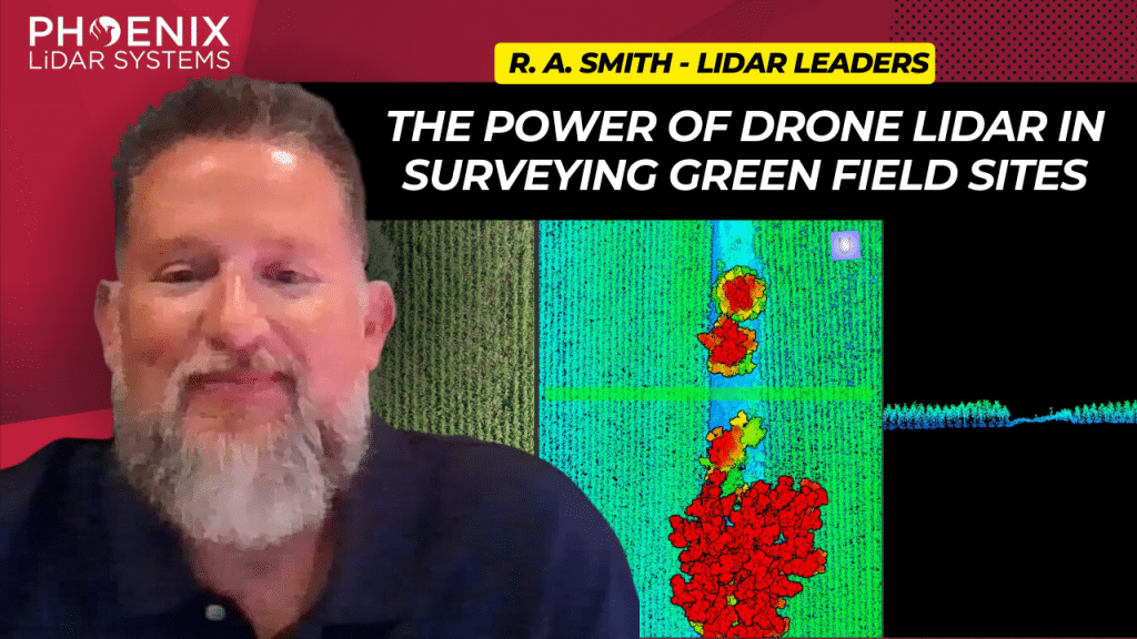
In the rapidly evolving world of surveying and civil engineering, technology plays a pivotal role in determining the efficiency and accuracy of data collection. Among the various technological advancements, LIDAR (Light Detection and Ranging) has emerged as a game-changer, especially in the area of aerial surveying. This video explores deep into the transformative impact of the Phoenix Mini Ranger 3, a state-of-the-art LIDAR system, on the workflows of R.A. Smith, a leading civil engineering and surveying company based in Brookfield, Wisconsin.
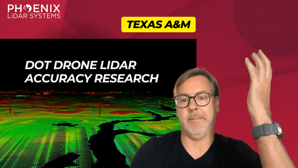
The Rise of LiDAR in Geomatics LiDAR, or Light Detection and Ranging, has seen a surge in its application within the geomatics sector. Its ability to capture detailed and accurate data makes it an invaluable tool for professionals seeking to analyze department of transportation survey and engineering projects. As the demand for high-quality data grows, the need to understand the strengths and weaknesses of available LiDAR sensors becomes paramount.