
promotion

Receive a 1 Year FREE Subscription to LiDARMill
($7800 Value)
($7800 Value)
Precision laser mapping and post-processing has never been easier. Our elite LiDARMill cloud-based post-processing platform, combined with our cost-effective RECON Series hardware, is the easiest, most complete toolkit available. And it’s only from Phoenix.
With the purchase of a RECON-A Mapping System
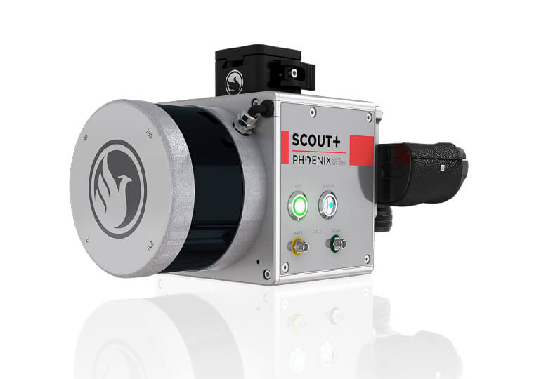
THE LIGHTEST, MOST COST EFFECTIVE LiDAR SYSTEM ON THE MARKET!
Watch the RECON-A in Action
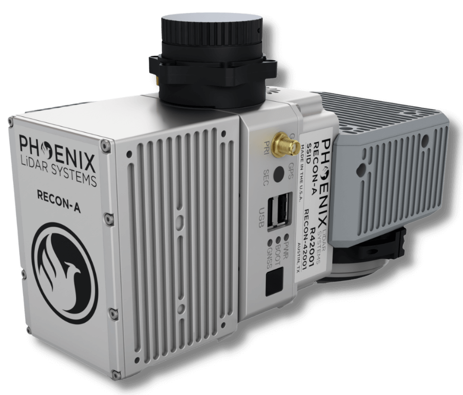
The RECON-A mapping system combines compact and lightweight design with improved detection range and efficiency at an affordable price point.
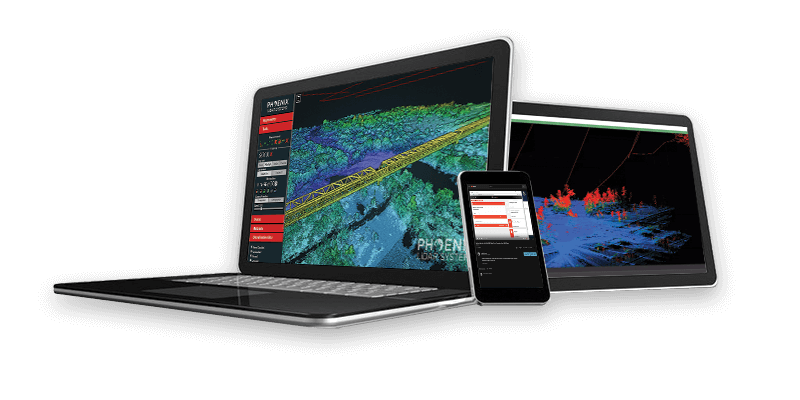
Phoenix LiDAR’s SpatialExplorer 7 software suite delivers a robust start-to-finish data acquisition and processing workflow where the user is in control.
The expandable SpatialExplorer suite from Phoenix LiDAR is built to ensure that your data acquisition is a success. From mission guidance to real time point clouds and easy field QC we leave nothing to chance when it comes to data collection.
For full control over each step of data post processing this desktop software has the professional tools you’ll need. LiDARSnap and CameraSnap provide industry leading results for datasets from airborne, mobile, or other platforms. Analytic tools then transform your highly accurate data into actionable products and automatically generated quality reports.
Acquisition
– Configure all system sensor and store custom profiles to ensure the correct settings during each acquisition
Post Processing
– Cloud and local GNSS/INS trajectory processing options
MissionGuidance
– Navigation guidance for pilots and mobile vehicle operators to stay exactly on the planned course
SE7 has additional functionality with SpatialPro add-on and/or MissionGuidance add-on. Check out all the features here!
Evolving the Capabilities of LiDAR
With the introduction of the RECON series, Phoenix LiDAR Systems is removing barriers to widespread LiDAR remote sensing adoption. The RECON series combines low-cost hardware with Phoenix LiDAR Systems industry leading software, LiDARMill, and is empowering a new generation of professionals like never before.
The RECON series features higher accuracies than competing products (that are based on Applanix or DJI navigation systems), while offering extremely simple, automated post-processing solutions to extract maximum value from each dataset.
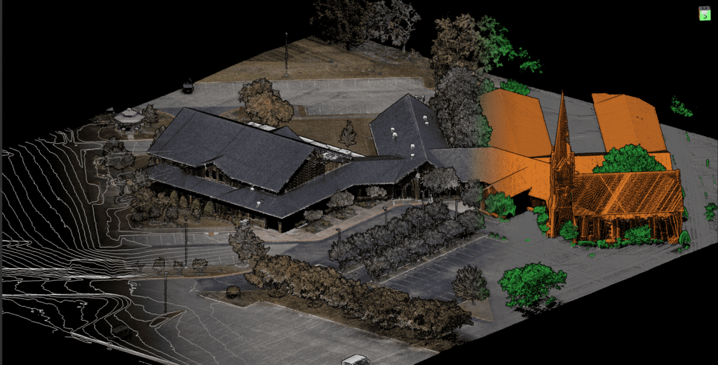
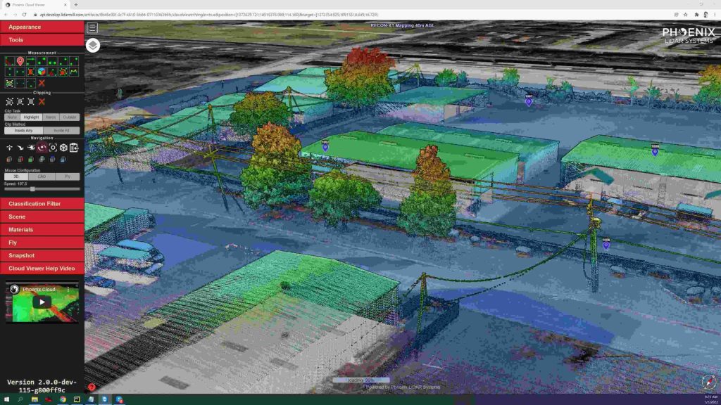
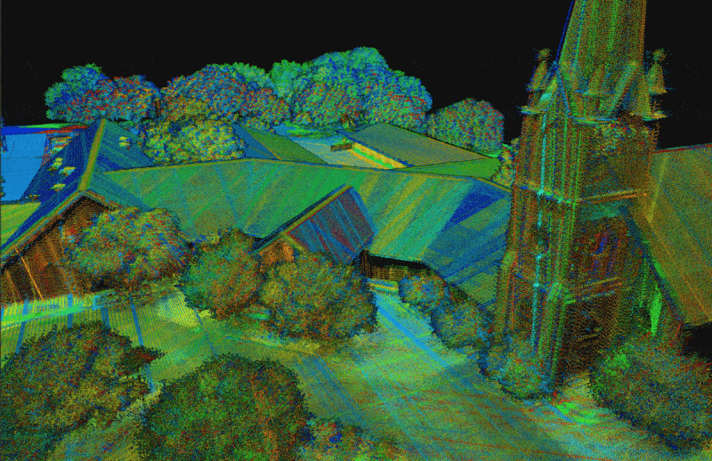
Utilizing the LiDARMill online, automated processing platform, raw datasets can be imported straight from a USB drive, with reference and optional ground control data seamlessly integrated. Simple wizards enable advanced processing options like trajectory optimization, LiDAR and camera calibration, AI classification, smart decimation and the creation of high-quality deliverables (contours, DTM/DSM/CHM, pointcloud tiling etc.). A fully registered, colorized pointcloud is produced that is accurate in both relative and absolute terms. Project reports then summarize project performance and verify system accuracy.
Phoenix Lidar Systems is committed to designing the world’s most advanced, complete LiDAR solutions. With the RECON + LiDARMill combination, users can deploy a simple toolkit that is able to derive accurate and reliable datasets in a matter of hours. Powerful, affordable, and comprehensive…the RECON series by Phoenix Lidar Systems is now available, and sure to disrupt the remote sensing industry.
Exclusive Promotional Offer! Scout Sale 2021. OUR LOWEST PRICES…EVER.
Ends June 15th, 2021
Promotion 1: Scout – 16 Basic Payload Package – Includes: Phoenix Lidar Systems Scout – 16 Payload System; Scout Accessory Kit; Sony A6k Lite 15mm Camera; Camera Kit; IMU – 25; Lidar Acquisition Training
Promotion 2: Scout – 16 Aerial Mapping Package – Includes: Phoenix Lidar Systems Scout – 16 Payload System; Scout Accessory Kit; Sony A6k Lite 15mm Camera; Camera Kit; IMU – 25; Phoenix Lidar Systems Spatial Explorer Pro v. 6 Software; NavLab Software; DJI Matrice 600 Pro Ready-to-Fly Package; Lidar Acquisition Training; Software Training; Pilot Training
Promotion 3: Scout Ultra Basic Payload Package – Includes: Phoenix Lidar Systems Scout – 16 Payload System; Scout Accessory Kit; Sony A6k Lite 15mm Camera; Camera Kit; IMU – 25; Lidar Acquisition Training
Promotion 4: Scout Ultra Aerial Mapping Package – Includes: Phoenix Lidar Systems Scout – 16 Payload System; Scout Accessory Kit; Sony A6k Lite 15mm Camera; Camera Kit; IMU – 25; Phoenix Lidar Systems Spatial Explorer Pro v. 6 Software; NavLab Software; DJI Matrice 600 Pro Ready-to-Fly Package; Lidar Acquisition Training; Software Training; Pilot Training
SpatialExplorer Pro 6.0 – 50% Off = Ends April 30th, 2021
SE Pro 6.0 is the evolution of a platform designed to carry you through every stage of collection and processing. Packed with production-oriented features, SE Pro 6.0 allows you to monitor & control the system during data collection, automatically boresight your data, apply cutting-edge algorithms to optimize the trajectory, apply control corrections, and generate the deliverables you commonly deliver to your client. Version 6.0 has several optimizations that are focused on creating the best deliverables in the shortest timeframe. Check out all the features here!