

Huge Problem Surveyors Face With LiDAR Data (And How To Solve It!)
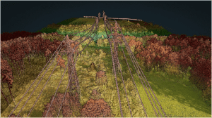
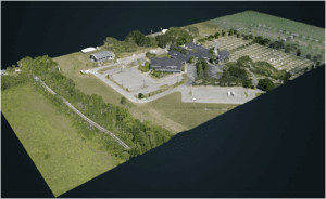
Surveyors face many challenges when it comes to getting the best and most accurate results for their clients. And this problem is made worse when they use low quality LiDAR software. In this video, Kory Kellum of Phoenix LiDAR Systems gives surveyors some tips on how to get the most accurate results possible using drone LiDAR data.
Click here for more information on LiDAR Processing software
