
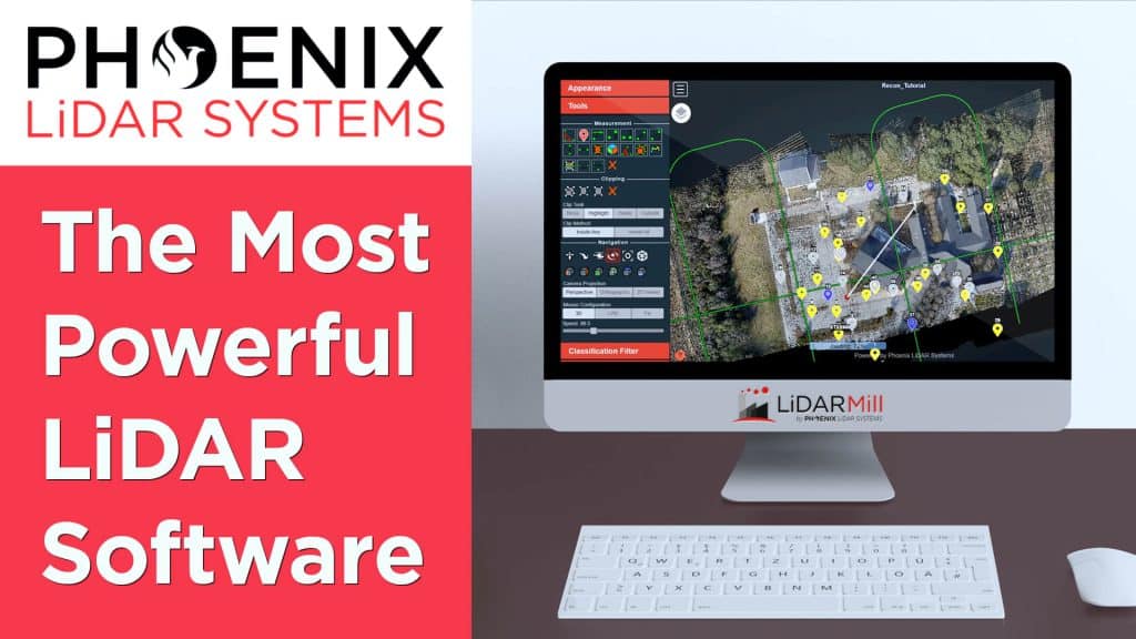
The Most Powerful and Easy To Use LiDAR Software – LiDARMill from Phoenix LiDAR Systems
LiDAR processing can be complicated, expensive and slow. But there is a great solution from Phoenix LiDAR Systems – LiDARMill. The cloud based software that can help you process LiDAR data quickly, accurately and inexpensively. And LiDARMill makes it easy to share LiDAR data with anyone. In this video, Kory Kellum of Phoenix LiDAR systems explains what LiDARMill is, who it’s for, and how you can try it for free!

