
Many users have recently discovered the benefits of mobile acquisition. Data density, accuracy, efficiency of collection and the ability to go where airborne vehicles often cannot makes this a highly valuable mapping option. Phoenix LiDAR systems and software are intentionally designed for vehicle flexibility, meaning you can acquire and process airborne, mobile, backpack, plus other types of data through a streamlined workflow. This webinar takes a close look at mobile lidar and imagery. We will discuss the data properties, advantages, considerations, and how Phoenix’s SpatialExplorer 7 software can be used to make the most of what you acquire.
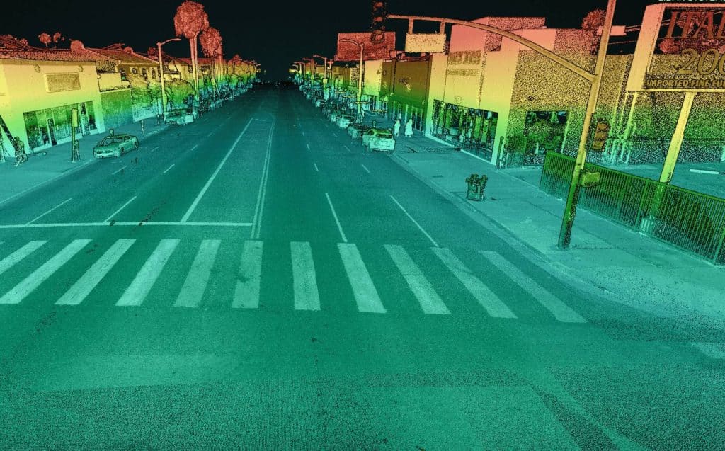
An Inside Look at Mobile LiDAR & Imagery Data Processing
falsefalse
Fill Out the Form to Download the Resource
Table of Contents
Related Posts

LiDAR in Animal Landscape Ecology Applications
October 8, 2021In this month's webinar, we hosted Evan Hockridge, a Ph.D. student at Harvard University’s Davies Lab. We discussed how his…
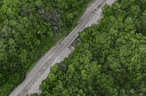
MiniRANGER-3 LITE | Rail
March 25, 2024Point Density: 473 points per m^2Height: 60 m AGL (approx.)Speed: 6 m/sData Acquisition Time: 8 minutes
The Benefits of Laser Scanning in Geospatial Engineering
November 22, 2023LiDAR technology, a groundbreaking innovation in the realm of surveying and remote sensing, has been a game-changer for many industries.…

