
KEY FEATURES


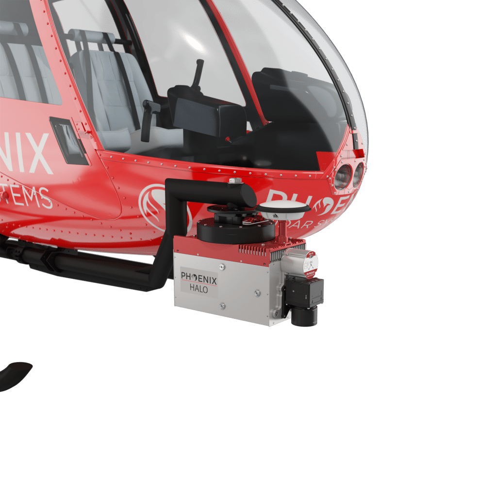
The HALO series LiDAR scanners are made for high-altitude, high-efficiency mapping. City-scale LiDAR projects are easily achievable with swath widths reaching 4,000 m. Selectable measurement rates up to 1 MHz and line speed up to 250 per second can be tuned to meet challenging pulse density specifications.
The HALO-H is available in two different models; the HALO-15H and the longer-range HALO-30H.
Full specifications
(1) Approximate values based on PLS test methods described at https://docs.phoenixlidar.com/accuracy-standards-and-quantification
(2) Using a 80° max downward field of view.
(3) Expected RMSEz when following the PLS recommended acquisition & processing workflow and ASPRS checkpoint guidelines.
(4) Flat surfaces with >20% reflectivity at the laser’s wavelength.
(5) Estimated post-processed
Accessories & Options

Dimensions
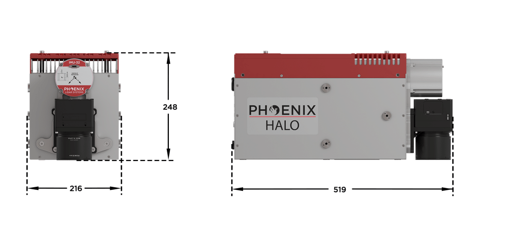
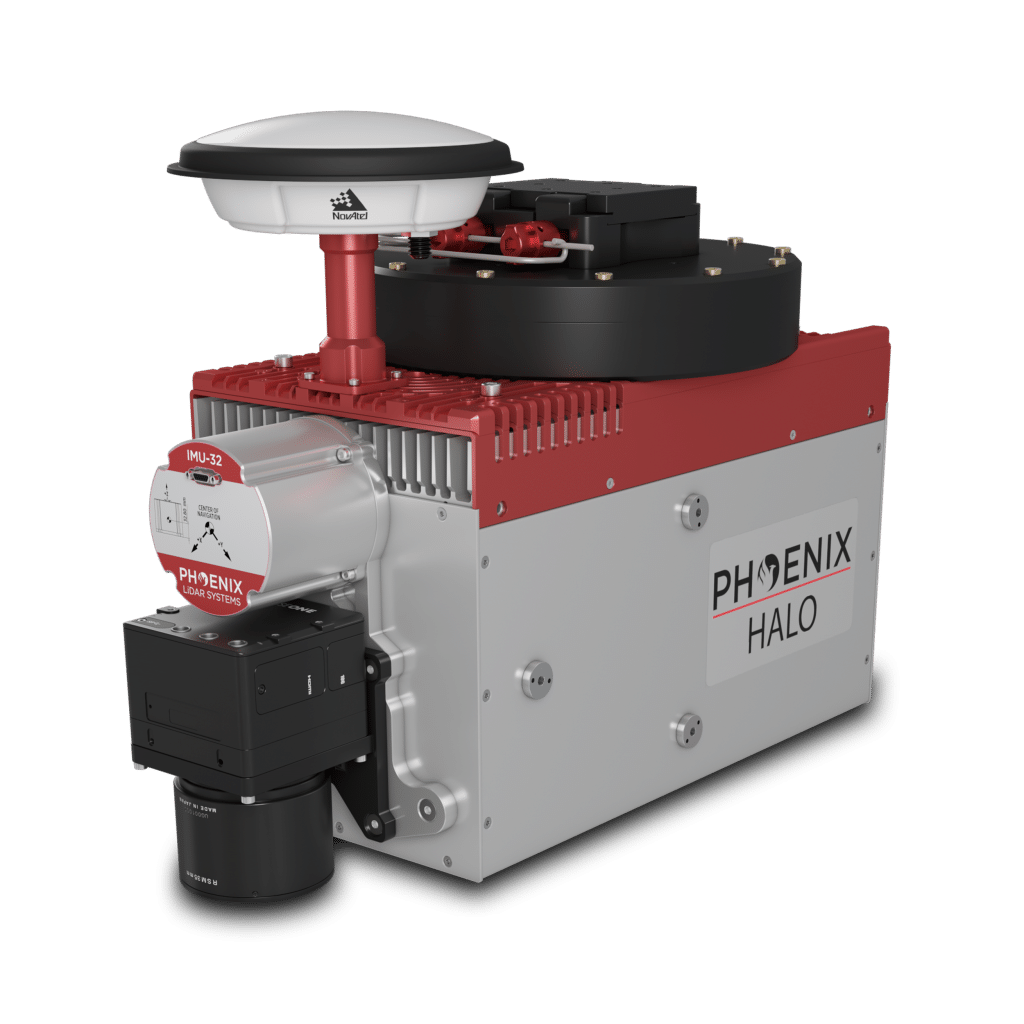
FRONT/LEFT
FRONT
Laser Scanners
GPS Mount
IMU
Camera Mount
LEFT SIDE
Accessory Mounting
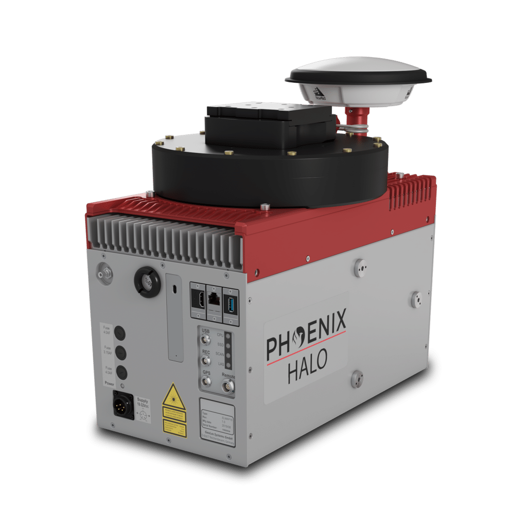
REAR/RIGHT
REAR
Power Button
Status LED
GPS Antenna 1-2
USB
Ethernet
RIGHT
Accessory Mounting


LiDARMill enables surveying teams to take advantage of precision laser mapping without investing in expensive software & training.