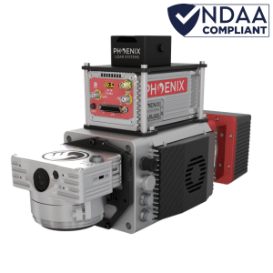
MiniRANGER-3 LITE

*In stock and ready to ship

AN UPGRADE TO THE RENOWNED MiniRANGER LITE - BOASTING A 3X INCREASE IN POINT DENSITY

The MiniRANGER-3 LITE is designed to provide survey-grade LiDAR data and imagery (optional) on an ultra-lightweight platform. Packed with options, the MiniRANGER-3 LITE leverages Phoenix’s years of experience and industry-leading LiDARMill software platform to provide a seamless user experience.
Optional mobile and backpack mounting options along with several imaging sensors provide the flexibility required to address every application. With the photogrammetry package, operators of mid-size multirotors can now simultaneously acquire survey-grade LiDAR data and high resolution 61 MP RTK photogrammetry at up to 100 m operating flight altitude.
*In stock and ready to ship

300k

Shots per Second @ 120°

20-30mm

RMSE @ 75 Range

290m

@ 60% Reflectivity

75m

Rec. Max AGL

2.2kg

Weight

Featuring the Phoenix LiDAR AIR NavBox

This RANGER system includes Phoenix LiDAR’s AIR NavBox. The newest generation, ultra-lightweight rover will help meet the rigorous demands of various industries and applications by greatly increasing flexibility in key areas:

  • Reducing weight to allow longer flight-times on lighter UAVs.

  • Much improved data throughput to accommodate multiple sensors producing more data as pixel count and pulse repetition frequencies increase.

The Phoenix LiDAR AIR NavBox offers the most industry-altering capabilities in a tiny box not much bigger than a standard-size computer mouse.

  • Dimensions:
    60 x 125 x 50 mm

  • Weight:
    450g

  • Control via button, 4G, wifi/ethernet

    Custom LiDAR Solutions

    Phoenix LiDAR Systems

    Build the system you need to meet the growing demands of your clients in varying industries, from mining to agriculture and construction to forestry.

    • Survey-Grade (cm-level) accuracy with 250m+ laser range and outstanding intensity calibration on high altitude and high speed missions
    • Penetrates vegetation to produce accurate results
    • Free online tutorials available; PLUS complete Acquisition/Post-Processing/Pilot/Certification training also available (fees may apply)
    • Free Phoenix Software Suite; plus NovAtel & Terrasolid options also available (fee may apply)
    • Live/Remote Data Feed: View and analyze data via 4G connection

    Optional Upgrades

    • Aerial systems
    • IMU and dual-GPS upgrade options for increased accuracy
    • Optional ground vehicle & UAV mounts/accessories
    • Service plans 

    Flexible Mounting Options

    The miniRANGER-3 LITE is designed to fly on more robust UAVs, including the M300 RTK, the M600 Pro, and more. This system can also be adapted for vehicle configurations with Roof Rack or Suction Cups.

    LiDAR Sensor Specs

    905nm

    Laser Properties: Class 1 (eye safe)

    20-30mm

    Absolute Accuracy: RMSE @ 75m Range

    15mm

    Range Accuracy: One Sigma @ 50m

    2m

    Minimum Range

    300k points

    Scan Rate

    5x

    Returns/Echoes

    360 degrees

    Field of View

    10-100 Hz

    Mirror Speed

    0.001°

    Angle Measurement Resolution

    0.05° ≤ ∆ϑ ≤ 0.5°

    Angular Resolution (Horizontal/Azimuth)

    160mm x 50mm

    Laser Beam Footprint @ 100m

    0.05° ≤ ∆ϑ ≤ 0.5°

    Angular Step Width (between consecutive laser shots)

    Point Density Speed & Altitude

    Phoenix Software Suite

    Phoenix LiDAR Systems provides a proprietary complete software suite for streamlined acquisition, geo-referencing, data fusion, export and post-processing in the cloud.

    Watch the miniRANGER in action.

    Visit our YouTube page for more videos, tutorials & more.