• 323.577.3366
  • Info@PhoenixLiDAR.com
PhoenixLiDAR Logo WhitePhoenixLiDAR Logo WhitePhoenixLiDAR Logo WhitePhoenixLiDAR Logo White
  • Hardware
    • Solutions Overview
    • (NEW) HALO-H10
    • RANGER
      • HydroRANGER
      • (NEW) RANGER-ULTRA+
      • RANGER-ULTRA
      • RANGER-XL
      • RANGER-LR LITE
    • PIONEER-360
    • MiniRANGER
      • MiniRANGER-3 LITE
      • MiniRANGER-LITE
    • SCOUT
      • SCOUT-M2X
      • SCOUT-ULTRA
      • SCOUT-32
      • SCOUT-16
    • RECON
      • RECON-XT
      • RECON-A
  • Software
    • FlightPlanner
    • SpatialExplorer
    • LiDARMill
    • MissionGuidance
  • Learn
    • LiDAR Sample Data
    • Case Studies
      • Rail
      • Mobile Mapping
      • Helicopter
      • Oil & Gas
      • Surveying & Engineering
    • Webinars
    • Videos
    • Learn about LIDAR
    • Applications
    • LiDAR Principles
  • Company
    • Company Overview
    • Customer Testimonials
    • News
    • Press Releases
    • Careers
  • Contact
    • Contact Us
    • Support
      • Teamviewer Download
      • Help Center
    • Request Quote
    • Feature Requests/Feedback
  • Log in
✕
Screenshot 2022 10 19 162751
Phoenix LiDAR RECON-A: The Lightest, Most Cost-Effective LiDAR System on the Market
May 4, 2022
LiDAR mapping solutions Custom 3D Mapping Solutions
Webinar: Phoenix LiDAR RECON-A vs. DJI Zenmuse L1
May 25, 2022

First Annual AltaFest 22′

May 24, 2022
Categories
  • News
Tags
LiDAR mapping solutions Custom 3D Mapping Solutions

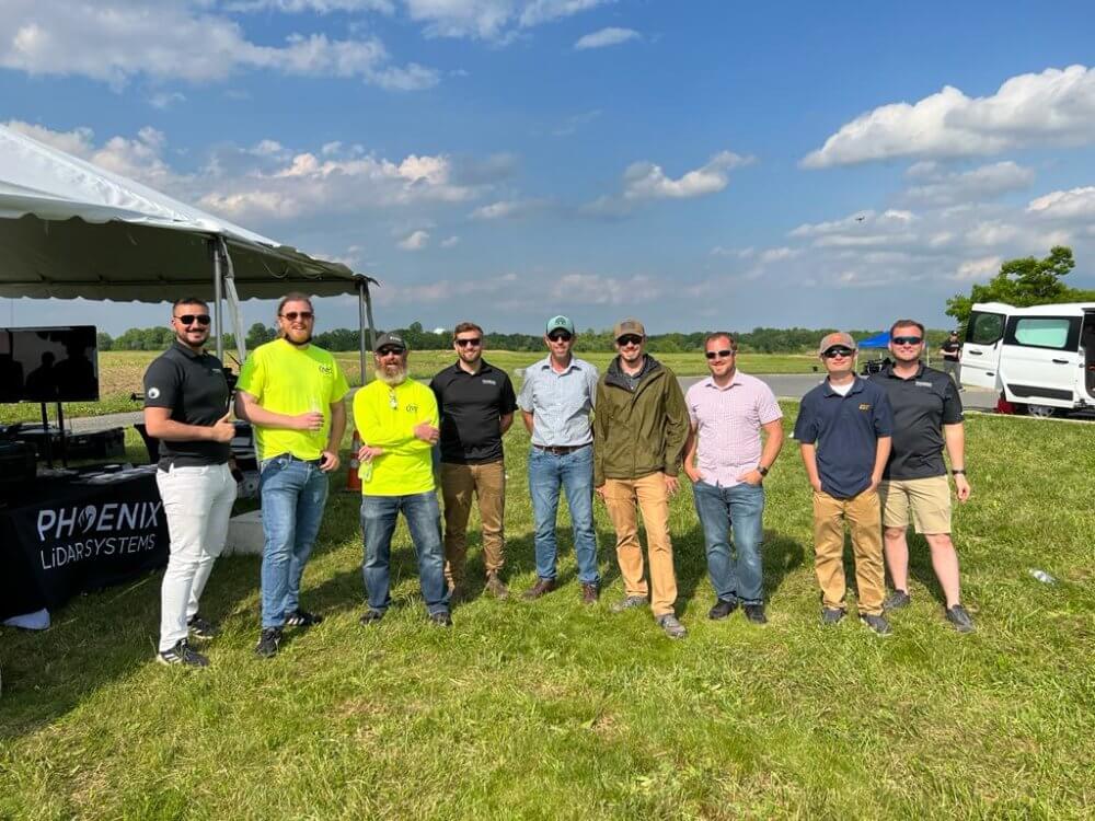
AltaFest May 19, 2022︱Mullica Hill, NJ

Thank you to the Freefly team for inviting us to present at this year’s first annual AltaFest! It was an honor to present alongside a variety of industry professionals, and show how Phoenix LiDAR Systems’ empowers the end user to collect the highest quality LiDAR data, with real-time quality control checks in the field. The user gets a friendly solution that instils confidence and eliminates the need for costly remobilization down the road.

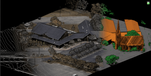
We followed up the data acquisition demo, visualizing the colorized/classified pointcloud collected from the scan site processed in SpatialExplorer7 Pro – a great desktop based option for post-processors looking to process data without an internet connection. SE7 Pro makes it quick and effortless to take cross sections to view vegetation penetration, and make accurate measurements.

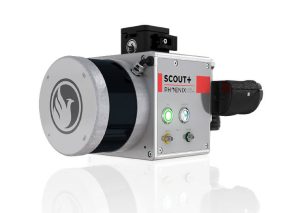
Transitioning to the presentation, our team covered the different solution tiers we offer, from the RECON series to the RANGER series, our acquisition best practices, and the post-processing workflows available using SE7 Pro and our cloud-based LiDARMill platform for a more automated processing experience.

Overall, the event was a complete success and we are already looking forward to the next one!


Share
6

Related posts

#image_title

February 23, 2023

What Happened at Geo Week 2023 in Denver, Colorado


Read more
February 22, 2023

RANGER-ULTRA+ Offers Increased Range and Resolution


Read more
Untitled design 2022 10 26T103943684
October 26, 2022

What Happened at INTERGEO 2022 in Essen, Germany


Read more

Comments are closed.


contact us

Phoenix LiDAR Systems
2113 Wells Branch Parkway
Building 1, Suite 4000
Austin, TX 78728

P: +1 (323) 577-3366

Monday-Friday
9:00 am – 5:00 pm CDT

quick links

LiDAR Systems Overview
View Sample Data
View Webinars
Get in Touch With Us
Request A Quote
Privacy Policy
Terms and Conditions

Subscribe to Our Newsletter

© 2022 Phoenix LiDAR Systems. All Rights Reserved.