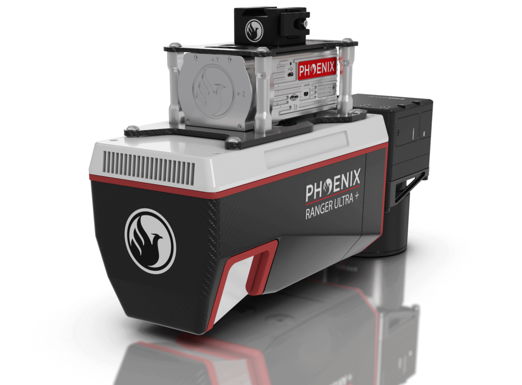
RANGER-ULTRA

*In stock and ready to ship


THE ULTIMATE CORRIDOR MAPPING SYSTEM


The RANGER-ULTRA is an airborne laser scanner with an impressive combination of weight, range, accuracy and pulse rate. It is equipped with a unique forward and rear looking FOV designed to minimize laser shadowing and provide geometry on complex vertical structures on a single pass. With its wide field of view of 100 degrees and an extremely fast pulse repetition rate of up to 1.8 MHz, the RANGER-ULTRA is perfectly suited for high point density corridor mapping applications such as power line, railway track and pipeline inspection.
Phoenix offers several RANGER-ULTRA camera accessories as well as UAV and manned aircraft attachment options. Please visit our booth or website to learn more about this amazing new addition to the Ranger series!


Request A Quote View Sample Data

*In stock and ready to ship


25-50mm

RMSE @ 350 Range

1800k

Shots per Second

720m

Rec. Max AGL

760m

@ 20% Reflectivity

3.0kg

Weight

FEATURING:
The New Phoenix LiDAR Systems AIR NavBox


The NEW RANGER-ULTRA includes Phoenix LiDAR System’s AIR NavBox. The newest generation, ultra-lightweight (450g) rover will help meet the rigorous demands of various industries and applications by greatly increasing flexibility in two key areas:
  1. Reducing weight for longer flight times on unmanned vehicles
  2. Higher range with the highest resolution cameras on the market.
The new Phoenix LiDAR AIR NavBox offers the most industry-altering capabilities in a tiny box not much bigger than a standard-size computer mouse.

58.5 x 123 x 48.1mm

Dimensions (W x D x H)

450g

Weight
 

Custom LiDAR Solutions

Phoenix LiDAR Systems


Build the system you need to meet the growing demands of your clients in varying industries, from mining to agriculture and construction to forestry.

  • Ideal for configuring heavier mapping payloads on the DJI M600
  • Survey-Grade (cm-level) accuracy with 250m+ laser range and outstanding intensity calibration on high altitude and high speed missions
  • Penetrates vegetation to produce accurate results
  • Free online tutorials available; PLUS complete Acquisition/Post-Processing/Pilot/Certification training also available (fees may apply)
  • Free Phoenix Software Suite; plus NovAtel & Terrasolid options also available (fee may apply)
  • High accuracy due to newest-generation MEMS IMUs
  • Live/Remote Data Feed: View and analyze data in real time or transmit live data to remote viewers via 4G connection


Learn why the RANGER-ULTRA is unmatched in performance and versatility.


Optional Upgrades
  • Aerial systems
  • IMU and dual-GPS upgrade options for increased accuracy
  • Integrated UHF radio modem
  • Optional ground vehicle & UAV mounts/accessories
  • Service plans 


Flexible Mounting Options

The RANGER-ULTRA is designed with flexible mounting options in mind. Easily mountable to unmanned platforms (UAVs) and to helicopters, gyrocopters, and other small manned aircrafts.


Phoenix Software Suite


Phoenix LiDAR Systems provides a proprietary complete software suite for streamlined acquisition, geo-referencing, data fusion, export and post-processing in the cloud.
 

Point Density Speed & Altitude