Point Density: 50,000+ points per m^2
Height: ~1.5 m AGL
Speed: Walking pace (~3-4 mph)
Data Acquisition Time: 10 minutes
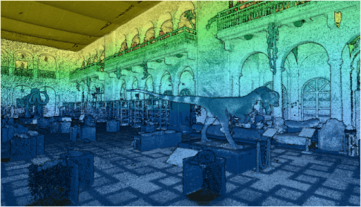
SCOUT-16 | Museum Mapping SLAM
Date: March 25, 2024
Fill Out the Form to Download the Resource
Related Posts

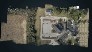
RECON-XT┃ UAS Mapping Mission
March 25, 2024Point Density: 510 points per m^2Height: 80 m AGLSpeed: 6 m/sData Acquisition Time: 3 minutes
Customer Spotlight – Mohawk College LiDAR Scanning at Niagara Falls!
March 31, 2020Mohawk College recently partnered with the Niagara Parks Commission on a critical project, utilizing their Phoenix LiDAR Scout 32 system…
Traditional Survey vs LiDAR
December 19, 2023Explore the transformative role of LiDAR technology in urban development through EHRA's use of the Mini-Ranger LiDAR system. This video…

